Economic Impact of Geospatial Technologies: An Indian Context
Published on by Water Network Research, Official research team of The Water Network in Technology
As economies and organizations script success stories, one of the unsung factors is the context of location and its impact in defining these successes. Contextualization of location is inherent to the way humans think and do things. Historically, governments, organizations, and citizens have relied on data and insights for actionable intelligence. Geospatial applications are improving the efficiency and productivity through spatial data and insights for planning, monitoring and analysis, stakeholder collaboration, operational readiness, asset management, improved customer services and so on.
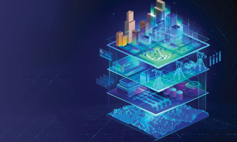
Be it the personal or business front, by putting geography in the backdrop, a new wave of geo-enabled digital transformation has brought unprecedented opportunities through data-driven insights, changing the way we look at things and the way we work on delivering a positive economic impact. Harnessing the context of geographic Big Data, technologies like Artificial Intelligence (AI), Machine Learning (ML), Augmented Reality (AR), Internet of Things (IoT), etc. are transforming the core of business practices through contextualized visualization of data, analytics and meaningful insights.
While the impact of Information and Communication Technologies (ICT) on the economy is now well documented, the value contribution of geospatial technologies is not talked about much. Despite the growing use of geospatial technology around the globe, its true economic value remains hidden, since the traditional measuring concepts have failed to keep up with the rapid evolution of the industry.
Geospatial as an industry in India creates employment in different sub-segments covering geo-data acquisition, processing, hardware and software sales and support, software development, and maintenance. As per Strategies and Recommendations for National Geospatial and Earth Observation Industrial Development Policy, published by Non-Executive Think Tank on Geospatial Strategy for New India, the geospatial workforce demand in India is expected to touch 10 lakh (1 million) by 2025. Geospatial technologies impact the economies of almost every industry segment.
“Geospatial as an industry in India creates employment in different sub-segments covering geo-data acquisition, processing, hardware and software sales and support, software development, and maintenance. The geospatial workforce demand in India is expected to touch 10 lakh (1million) by 2025”
Infrastructure
Modern life without infrastructure is unimaginable. While infrastructure makes a significant contribution to the economy, it also plays a vital role in social stability and environmental sustainability. With rapidly growing urban population, the need for infrastructure is constantly increasing for housing, commercial spaces, transport, utility and other civic amenities. Increasing competitiveness drives the need for geo-enabled digital transformation across the value chain in the sector.
Agriculture
Even without climate change, world food prices are expected to increase due to growing populations and rising incomes, as well as greater demand for biofuels. The changing climate will have a significant impact on the world’s food supply. Food producers and agriculturists need Geographic Information System (GIS) to understand the dynamics of agro-climatic features, evaluate risks and work towards adopting sustainable agricultural practices to make the sector more resilient. Using data-centric agriculture to improve productivity, safety, nutrition and sustainability can protect land and ensure sustenance for future generations.
Water
Water is undoubtedly one of the vital elements for existence of life on earth. Today, this very lifeline is under serious threat due to human activities of the past. Physical, biological, economic, and social processes too have a strong bearing on the water ecosystem which, unless addressed in totality, will not help in resolving the problem holistically. By harnessing the geographic context, GIS technologies provide unmatched capabilities to discover insights from data and transform how governments and communities see, think, and act towards integrated water resource management.
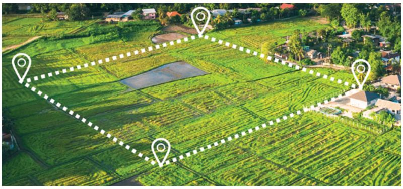
A GIS platform with image processing capabilities provides comprehensive land intelligence (Image credit: www.esri.com)
Taxonomy
- Geospatial Information Systems
- Spatial Planning
- Geospatial Services
- Economics & Policy
- Geo Spatial Technology
- Economics
- India