TECH NOTE: Site Selection for Continuous Surface Water Monitoring
Published on by Marcus Miller, Digital Marketing Manager at In-Situ in Case Studies
Introduction
Continuous, or unattended, environmental monitoring is becoming the standard method for water managers who need to collect data at a high frequency. In particular, long-term surface water monitoring is critical for understanding ecosystem changes over time and allows us to build models for predictions of future conditions based on natural and anthropogenic impacts. Unattended monitoring reduces field visits while increasing the amount of data collected, and continuous monitoring programs are safer and less costly over time.
One of the most important aspects of a successful monitoring program is site selection. Consideration of the physical and chemical characteristics of a monitoring location ahead of time can improve data quality and personnel and equipment safety. Here, we will cover several factors to consider when selecting a location for water sensor deployment.
Site Selection
Site selection is a balancing act between achieving project goals and ensuring that the site is safe and secure and offers the best representation of the whole water body. The first and most important factor to consider is the purpose of the monitoring project. This will dictate the water parameters being monitored, the duration of the monitoring program, and the sample frequency. The second factor to consider is data quality. The goal of every monitoring program should be to collect the best representative data to satisfy the project objectives, where possible. Data quality requirements must be balanced against the characteristics of the site location.
Mixing
Data quality at a monitoring site depends on the degree to which the deployment location represents the entire water body. It is impossible to monitor an entire lake or river for all parameters in question. So, monitoring equipment, whether the sensor itself or the intake of a pump system, must be positioned in a location that offers the best representation of the water body as a whole.
A spot where a river or lake is well mixed is the ideal place to monitor for water quality. Mixing must be verified by taking measurements in a horizontal cross-section of the water body (a horizontal profile), and if it is deep enough, taking measurements at various depths as well (a vertical profile at each section on the horizontal). The profiles must also be taken in different flow and depth conditions and during different seasons. Once the sensor is in place, it is important to continue profiling to see if changes in the profile warrant location reassessment.
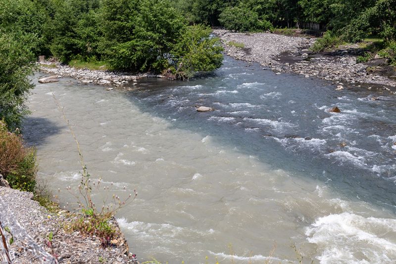
Full mixing of water bodies might happen several miles downstream from where they merged
If mixing in a chosen location is not sufficient to achieve data-quality objectives, it may be useful to deploy multiple sensors to capture data a single sensor might miss. A common method used to monitor lakes with vertical stratification is to use two or more sondes or pump intakes positioned at different depths in the water. For example, one might be placed close to the surface, one at the bottom, and a third at the midpoint.
For rivers and streams, it’s important to understand influents upstream of the monitoring location because they can change the water quality characteristics downstream. A site could be well-mixed at base flow, but rainy seasons and storm events can flush out inflow channels that are typically dry. Also, industrial effluent or stormwater runoff from a residential area could cause changes in water quality measurements due to pollution. Clarity around project objectives will help determine whether a particular site will help achieve project goals, or if an alternative site should be considered.
Velocity, Turbulence, Sediment, Debris, and Ice
Water velocity and turbulence at all flow stages need to be assessed at the site location before equipment is installed. High water velocity can pose a threat to deployed equipment because it can carry larger debris and can wash away installations and streambanks. Turbulence can help mix a stream or river, but it can also complicate dissolved oxygen and turbidity monitoring by causing air bubbles to become trapped on the sensors, which can cause false readings. Turbulence can also stir up sediment, which can falsely inflate turbidity measurements. It can also elicit false water level measurements in a pressure transducer by changing the pressure of the water against the sensor.
Before a deployment, it’s a good idea to assess river and streambed composition. Light sediments like sand and silt can shift during higher flows and storm events, which can bury instrumentation. If an instrument is clogged with sediment, sensor function will be impaired. Conductivity sensor readings will be off due to increased material in between terminals. And optical sensors’ emission LEDs will be blocked, preventing the detector from receiving fluorescence from the relevant parameter.
It isn’t always possible to choose a site with no potential for sediment movement, but there are ways to mitigate it to make sure instruments are not buried or fouled. Mounting the instrument higher in the water column or having multiple deployment stilling wells to accommodate equipment as sediment moves can help protect it. When mounting instruments on a shoreline, an angled stilling well with an open end can allow sediments to pass through the well rather than accumulating inside. Also, water bodies with rocky bottoms that move less and are less likely to damage your system are preferrable. However, it is important to remember that rocks can still move around in high flows, so the station construction should be sound to minimize damage.
Another factor to investigate at a potential monitoring location is the type of floating debris that could come into contact with your instrumentation. Depending on the type, debris can foul sensors, causing inaccurate readings, or even cause damage or loss of equipment. Like sediment, floating vegetation such as leaves and seagrasses can bury and clog an intake or stilling well. And larger debris, like fallen branches and trees, can get caught in equipment, potentially ripping out deployment pipes and cables, causing significant damage to your system.
In colder climates, ice can build up around the site and cause damage like that caused by large floating debris. When ice builds up in the winter and subsequently breaks up in the spring, shifting ice floes can detach a system from its mounts and damage or even carry away a station. Even a little ice can be dangerous; sensors like pH are especially susceptible to ice, which can crack or break the sensor’s glass bulb.
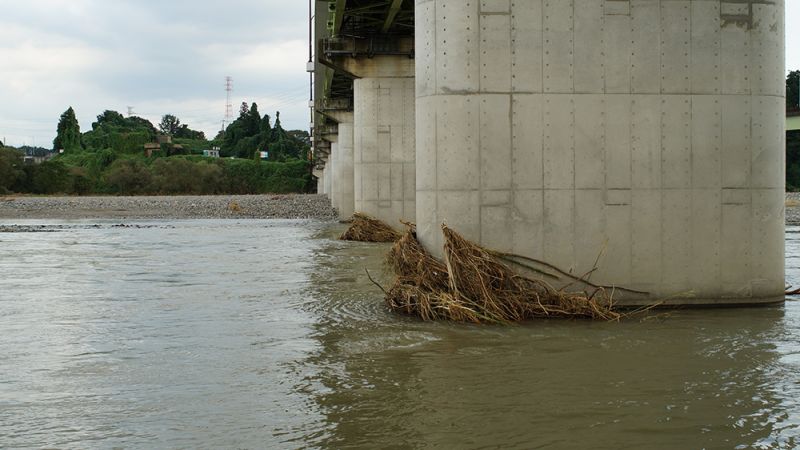
Floating debris can damage instrumentation.
Permitting, safety, human and wildlife traffic, and telemetry
In addition to environmental factors, there are other practical matters to consider when selecting a monitoring site. One is property ownership. Often, groups choosing a site will use GIS maps or Google Earth to find an ideal location for monitoring, only to discover that it’s located on privately owned land. In some cases, property owners are willing and even eager to participate in a monitoring program, but that generally isn’t the case. Finding a location on public property and getting proper permissions from the agency or government entity that owns it can sometimes be easier than obtaining permission from a private-land owner.
Water monitoring equipment often requires routine maintenance that involves regular site visits throughout the deployment period. Therefore, it’s also important to assess site access and equipment approach in all conditions and seasons prior to installation. Rainy weather can cause stage changes that could submerge your whole system or make the approach unsafe during high water.
Foul weather not only can cause flood stages in a river or reservoir but can also make an approach by vehicle difficult or impossible. It’s best to choose a site that remains relatively dry or has a convenient drive-up approach, such as a paved or gravel road. If the site is just off a street or road, make sure a safe approach is available so as not to cause a traffic safety issue. In these cases, it’s important to work with the local Department of Transportation office to create a traffic safety plan for the work site.
Having a sense of whom you might meet within the vicinity of your site, whether human or animal, can improve site visit safety. Wildlife can be a concern if the site is remote and larger, potentially dangerous animals live nearby. Smaller animals like beavers, rats, and other rodents might cause trouble by chewing through cables. And even domesticated animals can pose problems if the site is near a farm or ranch. Cattle, in particular, like to wade into streams and small rivers, where they can kick up turbidity in the water column and artificially increase those measurements.
As for humans, with any foot traffic around a monitoring location, there is an increased risk of vandalism and theft of expensive equipment. It’s best to try to monitor in a remote location where it’s less likely someone will stumble upon the equipment. People are typically attracted to things they can use or sell, so using low-profile instrumentation and forgoing solar panels and large batteries can help deter would-be thieves. And of course, using well-locking caps with padlocks helps as well.
Finally, an easily overlooked factor when choosing a monitoring site is adequate telemetry signal. Monitoring sites that are connected to telemetry—cellular, line-of-sight (LOS) radios, satellite, or some combination of these—require data transmissions to be unobstructed and strong enough for consistent connection. For cellular, it’s good practice to verify that an email can be sent from a cell phone at the proposed site. For LOS radios, the signal between the system radio and the second radio must be unobstructed by trees, buildings, or landforms like hills or mountains. Using directional antennas can help with signal strength between two locations and allow for more distance between the radios. For satellite, an unobstructed view of the sky is essential. A site clear of tree cover and tall buildings is an ideal location for satellite communications.
Conclusion
Site selection is key to achieving the objectives of a continuous environmental monitoring project, and finding the optimal site requires consideration of a multitude of environmental and practical factors. In order to obtain quality data and protect your installations from damage or loss, consider site characteristics including mixing, debris flow, ease of access and weather, as well as property rights, human and animal traffic, and communications, as you determine where and how a station will be installed.
Taxonomy
- Water Quality
- River Studies
- Hydrodynamics & Water Quality
- Water Monitoring
- Wetlands
- Water Monitoring
- Lake Management
- River Restoration
- Reservoir
- Water Quality Monitoring
- Water Quality Monitoring
- Water Quality Research
- Surface Water Hydrology
- Water Quality Monitoring Sensor
- Turbidity