World-first In Satellite Technology
Published on by Water Network Research, Official research team of The Water Network in Technology
Clyde Space has announced a partnership with conglomerate Teledyne e2v to deliver what the company refers to as a world-first in satellite technology.
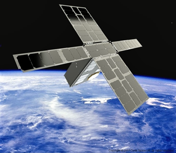
Image source: Satelite News
Craig Clark MBE, Clyde Space CEO, said in conjunction with Teledyne e2v that the company will create a new wave of space applications. With a high-tech solution provided by Clyde Space, the project team led by Teledyne e2v, working with research partner the University of Birmingham, is using quantum technology to provide a state-of-the-art technical solution capable of creating ultra-sensitive ‘cold atoms’ in space.
Applications for instruments based on this technology include more accurate monitoring of changes in polar ice mass, ocean currents and sea level, the ability to monitor underground water resources and discover new underground natural resource deposits which are currently not detectable.
The technology will also be used for deep space navigation and for providing higher precision timing sources in space. Laboratory experiments have shown cold atoms can be used as ultra-sensitive sensors capable of mapping tiny changes in the strength of gravity across the earth’s surface.
That will now be replicated in space through the Clyde Space-Teledyne e2v partnership with the Cold Atom Space Payload (CASPA) mission, the world’s first free-flying on-orbit demonstration for cold atom based science missions. It paves the way for cold atom instruments to be used in space.
The revolutionary technology is based on new developments in quantum technology which have resulted in the ability to cool atoms close to absolute zero making the cold atoms ultra-sensitive and capable of mapping tiny changes in the strength of gravity across the surface of the Earth.
Read full article: SatNews
Media
Taxonomy
- Technology
- GIS & Remote Sensing Technology
- GIS
- Geospatial Information Systems
- Water Resources
- Oceanographic Survey
- Sea Level Rise Vulnerability Assesment
- GIS Spatial Analysis
- Water Resources
- GIS & Remote Sensing