3D Scanning Shows early Signs of Dam Collapse
Published by Water Network Research, Official research team of The Water Network in Technology
Researchers are using a 3D scanner to predict the geographical conditions that cause dams to collapse.
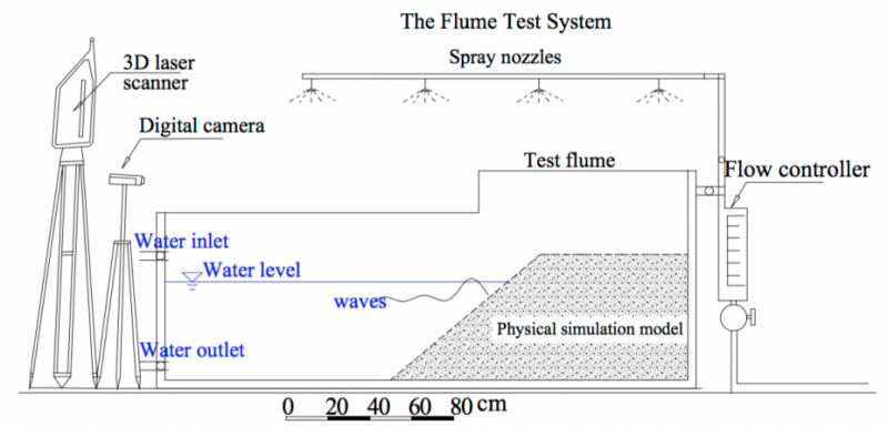
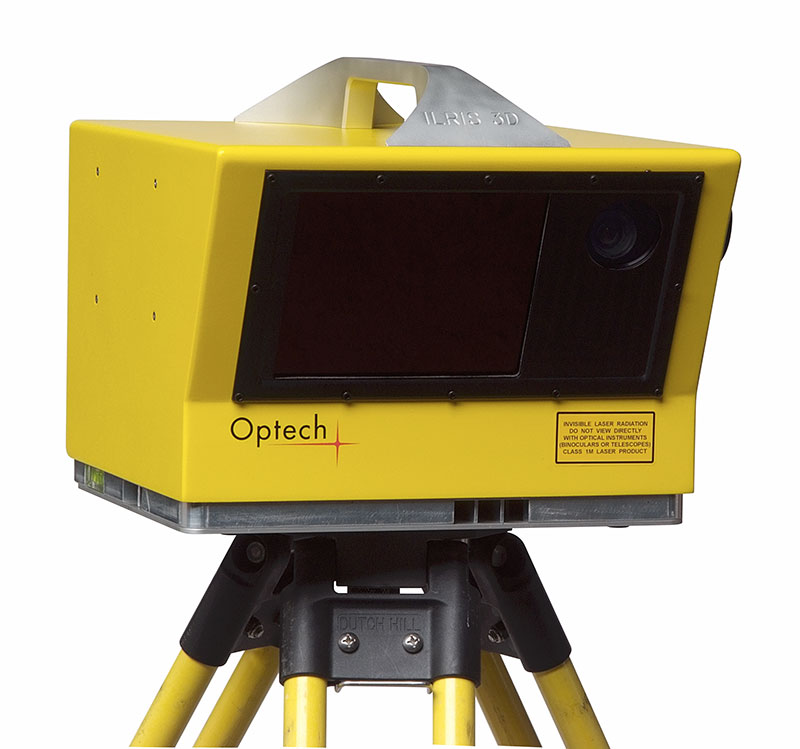 In a scaled-down model reservoir, the team used an Optech ILRIS (Intelligent Laser Ranging and Imaging System) to record different bank angles and determine the conditions where a critical failure might occur.
The study, titled Identifying the influences of geological factors on reservoir bank collapse by a model test draws on years of research made by leading geologists, including the statistical Bank-Slope Structure Prediction Method (BSSPM).
In addition to slope angle, the team examined four other variables to bank sensitivity: the density, clay proportion, wave height and water level, eventually finding that slope angle was the factor that had most effect on the bank’s probability to burst.
Collapsibility depended upon waves being able to affect a belt of erosion within the dam, and the team determined the angle of the slope above and below water, along with the length of the below water beach, that meant that the waves no longer had affect.
 Considering the devastating cost of a dam burst, such risk assessment is essential to reservoir engineering.
Though there are still discrepancies between forecasting and the actual outcome of a collapse, with the advancement of 3D scanning technology, and implementing it to predict such situations, it is hoped that such catastrophes cannot only be managed, but eradicated entirely.
Source: 3D Printing Industry
Tags
Category: Technology
- Hydrology
- Dams
- Hydrology