Does Saudi Arabia’s Desalination Capacity Pose a Severe Brine Threat?
Published by Dan Grech, Director at Global OTEC Resources in Technology
It was recently reported that Saudi Arabia is still leading the race for installed desalination capacity – now at 18% globally.
This comes after achieving 15% growth year-over-year, according to the Saudi Gazette. This means that 1.3 billion cubic metres through 3.7 million megawatt/hours of electricity in 2015
In November 2016 – Ras al-Khair’s desalination plant made it into the Guinness Book of Records as the world’s largest dual-function plant. The £5.4b project has an annual production capacity of 1.025 million cubic meters of desalinated water and 2,400MW of electricity.
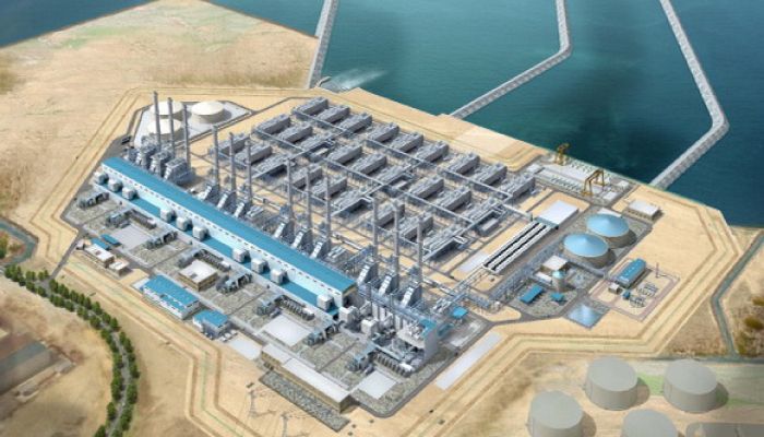
Efforts are also underway in Al Khafji to buiild a solar powered RO desalination plant capable of outputting 60,000 m3/day project. Abengoa launched a similar project in Accra, Ghana but there was controversy as locals complained that its output was too salty for drinking.
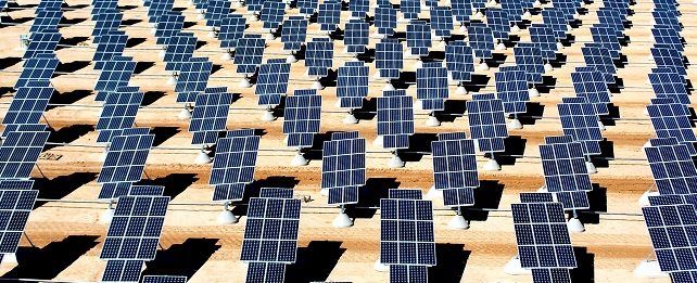
Whilst it’s impressive to see oil giant Saudi Arabia investing into renewable energy and reliance on desalination for it’s infrastructure plans are yet to be released of how the by-product will be disposed of.
Brine is a serious threat to the environment if not handled correctly. It can seriously harm the marine ecosystem or foul aquifers which can trigger devastating chain reactions. Given that the salinity of the water on Saudi Arabia’s east and west coasts have an above average salinity, it’s critical to the entire process that a ‘smart’ approach to brine disposal is in place.
I’ve reached out to NASA Aquarius Mission team to see if there has been any notable increases in salinity around the coastal plants.
UPDATE: NASA responded with the following message
"Unfortunately, it is doubtful that Aquarius (or any salinity-measuring satellite (SMOS, SMAP)) will be of much help in this because none of them work very well near land. About the closest Aquarius measured to a coast was on order of a 100 km. SMOS/SMAP might do a little better, but none are resolving within a kilometer or two of land masses. The issue is related to how they are detecting salinity, and the fact that land is so much brighter in the microwave region than seawater. However, even if they could work near land, which it is doubtful will ever be possible (and will certainly never be possible with the remaining salinity satellites (Aquarius failed in 2015)), there are some other problems with what you suggest.
The amount of water being withdrawn per day is tiny compared to the total volume it is being withdrawn from, so even if all the rejected brine is being put directly back in the ocean, the resulting increase in salinity would not be detectable. (To put this in numbers, they withdraw about 3.3x10⁶ m3/day of seawater. Assume the Saudi coastline is about 3x10⁶ m long, the intake is 2 km offshore and the average depth is 1 km. That gives 6x10¹²m3 of volume to take seawater from, meaning the total possible increase in salinity is around 0.5 parts per million, or about 17x10-6 psu. On a good day, with a well-calibrated thermosalinograph, I might be able to resolve 0.001 psu changes, a salinometer could do better, maybe 0.0001 psu, but a satellite can detect changes on order of 0.01 psu.
It is not clear that the Saudis are putting the rejected brine directly back into the ocean, but even if they are its density will make it sink to the bottom and not mix with the surface water. Therefore, there wouldn't necessarily be an increase in surface salinity.
A long enough time series from satellites to detect the change isn't available, and likely never will be. To see these changes, you would need a time series going back before large-scale desalinization was being done, and stretching out for decades.
Probably the changes in salinity due to changes in evaporation will be larger. The Red Sea, for instance, has a salinity of nearly 40 psu, which is 10% higher than water in the open ocean. Any changes in surface salinity in the Red Sea would have to be decoupled from changes in climate. That would be very hard to do in a coastal region.
What you need is access to data from a long-term insitu measurement program where they looked at salinity over a decade. There are ocean monitoring programs being done out of KAUST, but I have little detailed knowledge of them, or who you could talk to to access their data."
Source: Future Desalination
Tags
Category: Technology
- Environment
- Desalination
- Reverse Osmosis
- Brine Discharge Modeling & Analysis
- Desalination Plant
- Environment
- Desalination
2 Comments
Feed and bleed into a small, body of water with a negligible re-charge (i.e. The Arabian Gulf) where the "Feed" contains a contaminant, results in time with an exponential increase of that contaminant (hyper saline brine). The growth in salinity level may be modest to begin with but once the "bleed" (the desalination feed-source) contains higher salt levels, it follows that the Feed, the brine effluent, will contain greater levels of salt.
This is a logical, rational observation.
When the rate of Feed and Bleed increases, i.e. the Desalination capacity increases, as has been announced by all GCC states, then the exponential increase can be expected.
Soon, the ability to extract hyper saline quantities from the Bleed (or Feed-source) to make potable water will become exponentially expensive, ultimately leading to the collapse of the Desalination industry in the Gulf with a parallel collapse of the associated economies.
Zero Liquid Discharge (ZLD) technology must be employed at the first opportunity, hopefully before it is too late to enable recovery of the Marine environment and a consequent reduction in salinity levels to below 40g/L.
Published by Ron Daniel, General manager at Composium Group Ltd
Here is what NASA came back to me with:
"Unfortunately, it is doubtful that Aquarius (or any salinity-measuring satellite (SMOS, SMAP)) will be of much help in this because none of them work very well near land. About the closest Aquarius measured to a coast was on order of a 100 km. SMOS/SMAP might do a little better, but none are resolving within a kilometer or two of land masses. The issue is related to how they are detecting salinity, and the fact that land is so much brighter in the microwave region than seawater. However, even if they could work near land, which it is doubtful will ever be possible (and will certainly never be possible with the remaining salinity satellites (Aquarius failed in 2015)), there are some other problems with what you suggest.
The amount of water being withdrawn per day is tiny compared to the total volume it is being withdrawn from, so even if all the rejected brine is being put directly back in the ocean, the resulting increase in salinity would not be detectable. (To put this in numbers, they withdraw about 3.3x10⁶ m3/day of seawater. Assume the Saudi coastline is about 3x10⁶ m long, the intake is 2 km offshore and the average depth is 1 km. That gives 6x10¹²m3 of volume to take seawater from, meaning the total possible increase in salinity is around 0.5 parts per million, or about 17x10-6 psu. On a good day, with a well-calibrated thermosalinograph, I might be able to resolve 0.001 psu changes, a salinometer could do better, maybe 0.0001 psu, but a satellite can detect changes on order of 0.01 psu.
It is not clear that the Saudis are putting the rejected brine directly back into the ocean, but even if they are its density will make it sink to the bottom and not mix with the surface water. Therefore, there wouldn't necessarily be an increase in surface salinity.
A long enough time series from satellites to detect the change isn't available, and likely never will be. To see these changes, you would need a time series going back before large-scale desalinization was being done, and stretching out for decades.
Probably the changes in salinity due to changes in evaporation will be larger. The Red Sea, for instance, has a salinity of nearly 40 psu, which is 10% higher than water in the open ocean. Any changes in surface salinity in the Red Sea would have to be decoupled from changes in climate. That would be very hard to do in a coastal region.
What you need is access to data from a long-term insitu measurement program where they looked at salinity over a decade. There are ocean monitoring programs being done out of KAUST, but I have little detailed knowledge of them, or who you could talk to to access their data."
Published by Dan Grech, Director at Global OTEC Resources