Information About the World’s Water at Your Fingertips
Published on by Water Network Research, Official research team of The Water Network in Technology
UNESCO launched the Water Information Network System (IHP-WINS). This database is open for anyone to use and contains reliable information about the entire world’s water resources.
The Water Information Network System is an open source and open access platform that combines geolocalized data.
The idea is to have a reliable source of information for responsible resource management. You can access the database here.
This user-friendly, interactive tool can be used by a wide variety of stakeholders, to explore the data and generate customized maps.
This database is built on GIS so anyone can make their own maps and explore information about the world’s water resources; it is very interactive. It can be used by someone who’s just curious or for decision-makers. There is information about rainfall, arid zones, irrigation, and entire water basins.
This is the first time that information about the entirety of the water cycle has been combined into one platform.
Create a map
First, you choose a base map, either of the whole world or a specific region. Then you can add different available layers. Each layer contains information about some aspect of water use so that you can really see patterns and analyze what you see.
Some examples of available layers are karst areas, glaciers, groundwater, pathogens, school, agriculture, aquifers, biodiversity, and dams. More than 150 layers of geolocalized data are available. There are almost unlimited options of areas and factors to explore!
You can view maps created by other users. Some examples of the vast number of uses with this data are analyze the distribution of dams in Asia, the ratio of female learners to school toilets in the world, or groundwater-dependent cities on areas with groundwater stress.

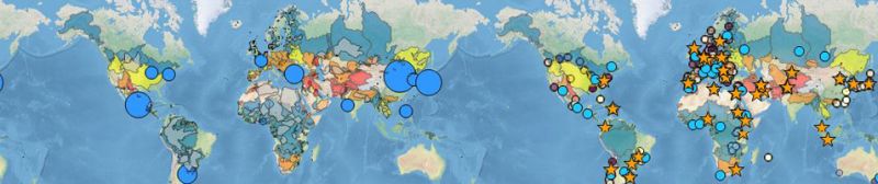
You can combine many layers in GIS to give you information about how water resources are distributed globally. Image credits: United States Geological Survey
Sources: ZME Science and UNESCO
Attached link
http://www.youtube.com/embed/w88e3o9AMTsMedia
Taxonomy
- Resource Management
- Water Access
- Technology
- Water Resource Mapping
- GIS
- Data Management
- GIS for network
- Water Supply
- Water Management
- Groundwater Mapping
- GIS Spatial Analysis
- Water Software
- Software Solutions
- Software
- Data