Miniaturised Hyperspectral Cameras to Monitor the Landscapes
Published on by Water Network Research, Official research team of The Water Network in Technology
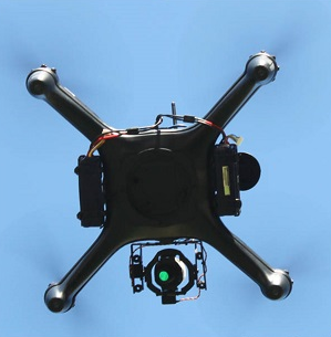
Meet the new face of environmental monitoring – a combination of unmanned aerial vehicles (UAV) and a highly specialised camera, once so big and expensive only satellites could carry them.
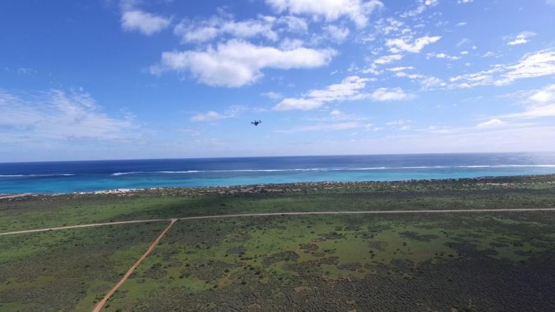
QUT's hyperspectral camera takes off for Ningaloo Reef. Photo: QUT REF
QUT remote sensing researchers and UAV engineers are pioneering the use of new miniaturised hyperspectral cameras to monitor the health of Australian landscapes in more detail than ever before.
Project leader Associate Professor Felipe Gonzalez said his team was among the first in the world to obtain aerial hyperspectral imagery of a coral reef in extraordinary resolution – the pristine Ningaloo Reef at the Ningaloo Coast World Heritage site in Western Australia - in a data-gathering mission that will help inform future research.
"Normal cameras record images in three bands of the visible spectrum – red, green and blue – mixing those bands together to create colours as humans see them," said Professor Gonzalez, from QUT's Institute for Future Environments (IFE).
 "By comparison, the hyperspectral camera captures 270 bands in the visible and near-infrared portions of the spectrum, providing far more detail than the human eye can see.
"And, as we're flying it on small UAVs at 30-100m over the water, the data collected is of an incredibly high resolution."
Professor Gonzalez said new lightweight hyperspectral cameras would open many possibilities for reef monitoring and collaborations with marine researchers.
"UAVs are a cost-effective sensor platform and a great complementary tool to existing satellite, manned aircraft and underwater surveys," Professor Gonzalez said.
"Large-scale, high-altitude surveys of the Ningaloo and Great Barrier reefs may lack the resolution necessary to identify individual corals, so this is the niche for low-altitude UAV surveys."
Using data collected by engineers in the IFE's Research Engineering Facility (REF), Professor Gonzalez and his team are developing revolutionary software to quickly analyse the airborne hyperspectral information from Ningaloo reef, and for a wide range of other environmental purposes, including detecting invasive plants in Western Australia and diseases in wheat crops.
NASA's Coral Reef Airborne Laboratory (CORAL) mission is currently conducting hyperspectral mapping of the Great Barrier Reef at high altitude with manned aircraft.
Read more on: Phys.org
Attached link
http://www.youtube.com/embed/Ao9UT6IGRRsMedia
Taxonomy
- GIS & Remote Sensing Technology
- GIS
- Data Management
- GIS for network
- Environment
- GIS Spatial Analysis
- Digital Cameras
- GIS & Remote Sensing
- Cameras
- Satellite
- Data