New Flood App Eases Access to Critical Water Data
Published on by Water Network Research, Official research team of The Water Network in Technology
A handy new web app makes getting critical water data a snap no matter weather bad or good, and it might even save your life.
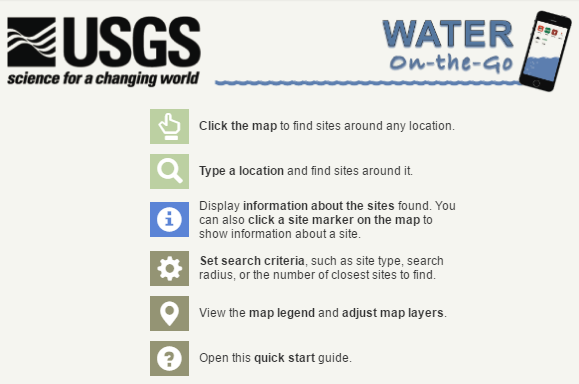
The United States Geological Survey, or USGS, recently launched "Water On-The-Go" -- a web application that uses your location to pinpoint and display data about nearest waterways.
Printscreen: txpub.usgs.gov/water-onthego/
Corresponding stream information, like stream stage (or height) and flow rate, then displays for each of the sites nearby, along with a "rising" or "falling" arrow indicator.
Click on any of the sites and you'll see historical data with the most recent stage and flow rate graphed out.
Users will probably find the easiest way to access "Water On-The-Go" is via a smartphone, yet we must stress the importance of remaining hands-free while driving.
Once you access the "Water On-The-Go" site, your smartphone GPS data allows the app to find you. If on a desktop, location services must be enabled in your browser for the auto feature to work.
Or one can simply navigate the interactive map and click anywhere for a look at the waterways all across the Lone Star State.
Texas is the testbed for this new app.
Flash flooding is the number 1 storm-related killer in Texas. More people are killed in their cars during floods than any other way. Where water flows over roads, turn around, don't drown!
Attached link
http://www.youtube.com/embed/0J6Eykoj03EMedia
Taxonomy
- Data Management
- Integrated Water Management
- Water Management
- Water Management
- Mobile Apps
- Data