Notices - Geographic Information Systems (GIS)
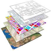 Geographic Information Systems is a computer system for capturing, storing, checking, and displaying data related to positions on Earths surface. GIS is great tool to manage the water resources. This group is dedicated to share knowledge about GIS trends helpful for water sector.