Researchers Measure Carbon Footprint to Build the New Romaine Hydroelectric Dams
Published on by Water Network Research, Official research team of The Water Network in Technology
UN researcher is collecting the first data on areas flooded to build the new Romaine hydroelectric dams in a bid to assess the project's impact on the region.
By Clément Sabourin

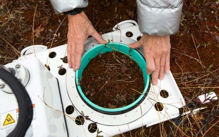
Researcher Michelle Garneau tests soil in a peat bog to gauge the climate impact of the giant Romaine hydroelectric dam project (Image Credit: AFP / Lars Hagberg ; Image Source: phys.org)
Michelle Garneau, a university researcher and a member of the UN's Intergovernmental Panel on Climate Change (IPCC), is collecting the first data on areas flooded to build the new Romaine hydroelectric dams in a bid to assess the project's impact on the region.
While renewable hydroelectricity itself is considered to be one of the cleanest sources of energy on the planet, there is currently no proven model for calculating the greenhouse gas emissions released by flooding huge areas behind new dams.
With the construction of four new dams on the Romaine River in northern Quebec nearly complete, researchers saw an opportunity to try out new techniques to measure its carbon footprint.
The team led by Garneau zeroed in on a swamp a mere stone's throw from the raging river in the wilds of Canada's boreal forest, an area accessible only by helicopter.
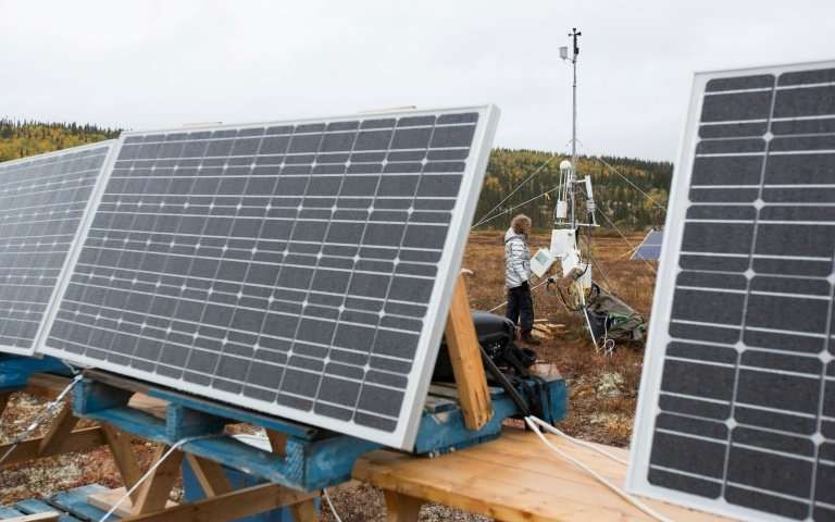
After landing, she takes several boxes out of the belly of the aircraft and places them next to some solar panels and a portable weather station that she and her students installed over this summer.
The devices are expected to produce sample data within two years.
"Every 20 minutes, the cone will capture and measure the breathing of the soil," she explains, placing a transparent device that resembles a handbell on the lichen, as wild geese honk and cackle overhead.

AFP / Lars Image Credit: Researcher Michelle Garneau's team is building a temporary weather station to record data from the area near the Romaine hydroelectric dam project in Canada's Quebec province (Image Credit: AFP / Lars Hagberg; Image Source: phys.org)
She takes a few steps further on the unstable ground and places a box that connects to sensors already sunk into the ground.
"This automated device to measure the photosynthetic activity records the CO2 and methane emissions every three minutes, for hours," the researcher says.
Carbon dioxide (CO2) and methane emissions are the main sources of global warming.
Another team is measuring carbon dioxide emissions from artificial lakes created by flooding lands behind dams, for eventual comparison.
Read the full story at PHYS.org
Media
Taxonomy
- Flood Management
- Flood Modeling
- Dams
- Flood management
- Flood damage
- Flood prediction
- Flood Risk Management
- Non-Renewable Resources
- Soil Carbon
- Carbon
- Flooring Solutions
- Activated Carbon
- Soil Science
- Non Destructive Testing of Dams
- Renewable Energy
- Renewable Energy Technologies
- Hydroelectric Energy
- Renewable Energy
- Renewable Energy Power
- Renewable Water Resources
- Carbon Footprint
- flood protection
- Renewable Energy