Software Shows Potential Impact of Rising Sea Levels on US Cities
Published on by Robert Brears, Founder of Our Future Water, Young Water Leaders, Mitidaption & Author (Springer Nature, Wiley) in Business
An interactive mapping tool provides a scary glimpse of how cities such as New York, Boston and Miami might end up if sea levels continue to rise.
***Article by Dan Howarth
The Google Earth plugin, Surging Seas: Extreme Scenario 2100, allows users to pan around 3D imagery of America's coastal cities and see what they would look like if sea levels rose by eight feet (2.4 metres).
It was created by the Climate Central organisation to warn of the effects of climate change on some of the country's most densely populated places.

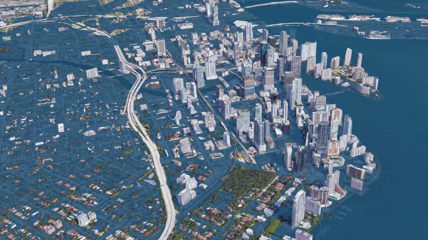
The Surging Seas: Extreme Scenario 2100 interactive maps show what cities like Miami would look like if sea levels rose eight feet (2.4 metres)
Once downloaded and installed, the software overlays Google Earth's 3D renderings of cities to show which areas would be affected.
When applied to New York, almost all the streets in Lower Manhattan's Financial District appear under water, along with large portions of the West Side, Chelsea and the Lower East Side.
The majority of Long Island City, Flushing Meadows and the Rockaways in Queens are washed out, while Brooklyn's Greenpoint, Red Hook and Navy Yards take severe hits.
Landmarks like Ellis Island and LaGuardia Airport would also be completely submerged.

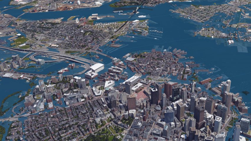
Large areas of Boston appear underwater in the visuals, which are overlaid onto Google Earth
The scenario looks even worse for Miami, which is entirely consumed by water in the visuals, with just the tops of buildings and elevated infrastructure visible above the blue wash.
Only the highest points of Boston remain above the water level, while much of the harbourfront, the universities in Cambridge and most of the southern neighbourhoods are shown as flooded.
A similar scene is found in Washington DC, where the Potomac River has reclaimed a large section of the capital.
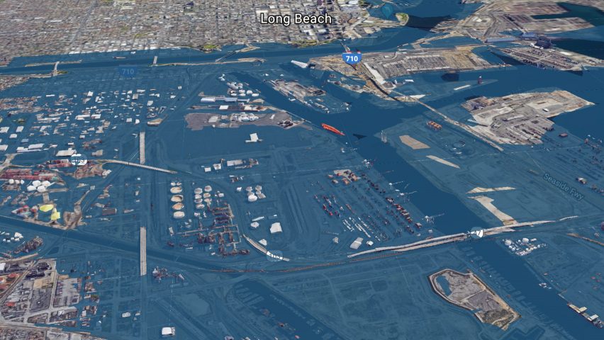
The software also works for Los Angeles, where most of Long Beach is presented drowned, and San Francisco, whose airport and several waterfront communities along the bay succumb to the sea.

The software works for several US cities, including Los Angeles, where Long Beach is shown almost entirely under water
Climate Central has also produced a 2D interactive map to show areas under threat from rising sea levels. It includes a slider that can be adjusted for global temperature rise, with predicted water heights for each 0.5 degrees Celsius increase mapped over landscapes.
Aware of the threats, coastal cities across the US are already taking steps to lessen or prevent the impacts of climate change. Boston has launched a plan to protect its inhabitants with elevated parks and barriers, while the Bay Area has asked ten teams of architects and engineers to come up with solutions for the region.
The topic was also on the agenda during Dezeen's Good Design for a Bad World talks during last year's Dutch Design Week, when speakers discussed how designers can help tackle the world's big problems.
Attached link
https://goo.gl/1X8XpJMedia
Taxonomy
- Research
- Coastal Engineering
- Coastal
- Climate Change
- Climate Change Adaptation
- Climate Change Resilience
- Infrastructure