Online Tool Pinpoints Bangladesh Water Irrigation Sites
Published on by Water Network Research, Official research team of The Water Network in Technology
Scientists from the International Maize and Wheat Improvement Center are researching the best way to increase double cropping in Bangladesh, and they suggest new online geospatial tool.
In the northwest of the country, farmers already rotate at least two crops in the same field each year using groundwater irrigation to overcome drought risks during the dry winter season.
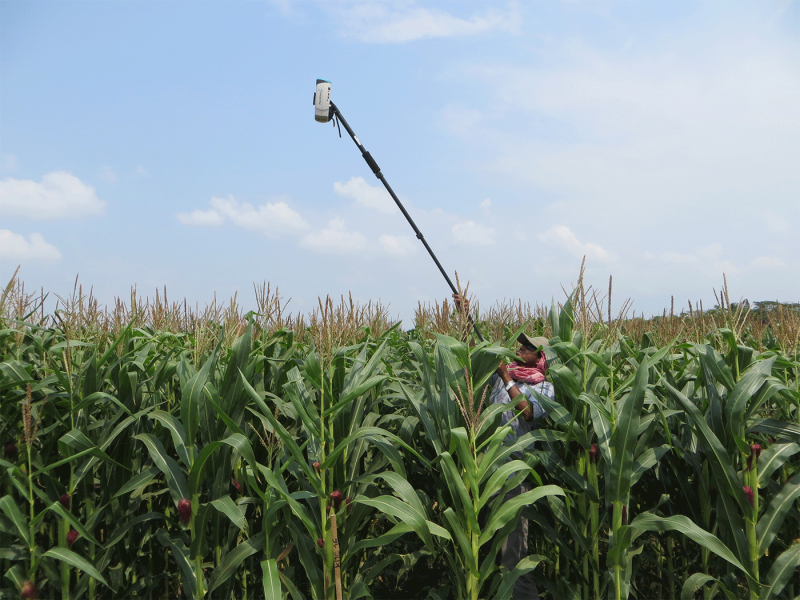
STARS scientists measuring the maize crop canopy in Putakhali, Sothern Bangladesh
“Most development initiatives favor the use of groundwater resources for irrigation, although in Bangladesh, ground water extraction can result in high energy costs and in some areas can present a health risk due to natural arsenic contamination of groundwater,” said Timothy Krupnik, systems agronomist at CIMMYT.
“In support of government programs recommending the conjunctive use of surface water as an irrigation alternative, we investigated the available land in Bangladesh that could be reliably cropped to wheat, maize, or rice in double cropping patterns,” Krupnik said, adding that the effort resulted in a new online geospatial tool - Spurring a Transformation in Agriculture through Remote Sensing (STARS) is geospatial tool for targeting surface water irrigation for crop intensification.
It helps identify surface water irrigation resources and land area most suited for double cropping and sustainable intensification.
“Using satellite data for irrigation technology targeting in Bangladesh enabled us to identify areas that are under low input and output crop production in a region with abundant surface water,” said Urs Schulthess, CIMMYT’s remote sensing scientist involved in developing the geospatial tool. “This is an example of sustainable intensification that does not deplete water resources.”
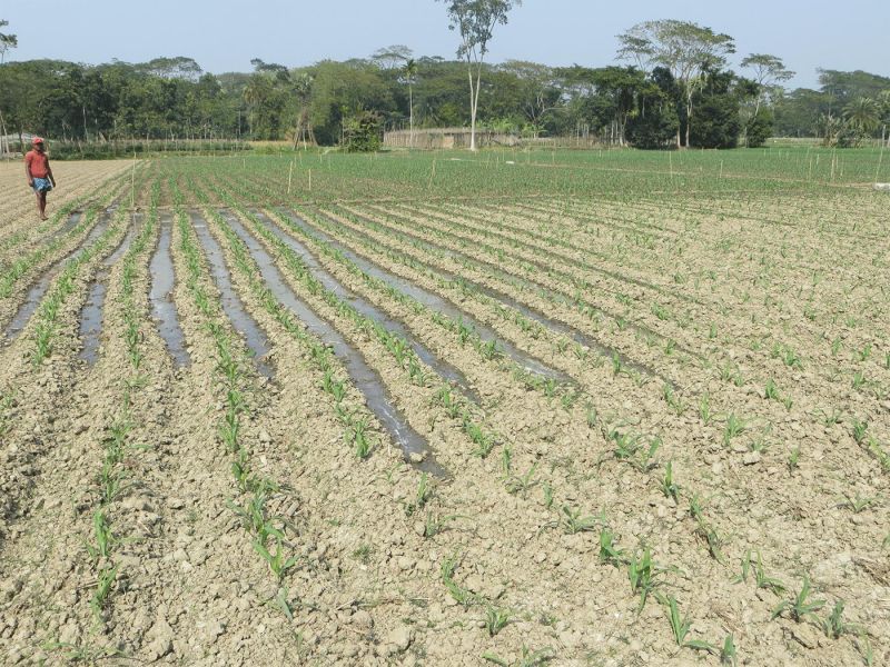
Water-saving irrigation of a maize crop using raised beds, in Southern Bangladesh
Instead of extracting water from underground aquifers, surface water irrigation involves deploying water through low-lift irrigation pumps and canal distribution networks managed by water sellers who direct water to farmers’ fields. Although Bangladesh is likely to remain largely reliant on groundwater irrigation, use of available surface water presents a low-energy and low-carbon emissions alternative in select areas of the country, Krupnik said.
The research conducted by scientists working with the CIMMYT-led Cereal Systems Initiative for South Asia (CSISA) project, provides initial evidence to support a government of Bangladesh policy aimed at stimulating a $500 million investment in development aid from donors to help farmers transition from rice-fallow or rainfed systems to surface water irrigation and double cropping.
The funds form part of an overall request for investment of over $7 billion to support agricultural development in southern Bangladesh.
After mapping rivers and freshwater canals in southern Bangladesh with the new tool, the scientists conservatively estimate that at least 20,800 of fallow and 103,000 hectares of rainfed cropland could be intensified through surface water irrigation to substantially increase cereal crop production through double cropping. These figures account for land set into non-crop reserves to limit risks of nitrate or phosphorous contamination of rivers and canals.
Read more at: Thomson Reuters
Media
Taxonomy
- Agriculture
- Irrigation
- Water Scarcity
- Resource Management
- Agriculture
- Water Resource Management
- Technology
- GIS & Remote Sensing Technology
- GIS
- Water Resources
- Consumption
- Irrigation Management
- GIS Spatial Analysis