Putting Satellite Maps of Surface Water to Practical Use
Published on by Water Network Research, Official research team of The Water Network in Technology
The SWOT satellite mission will make the first global survey of Earth’s surface water to serve the hydrology and oceanography communities.
By Faisal Hossain, Alice Andral, and Margaret Srinivasan

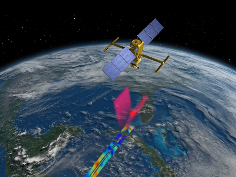
The SWOT mission, planned for launch in 2021, will collect high-frequency data for mapping the world’s water elevations. In this artist’s conception, the SWOT satellite uses radar interferometry to perform topography measurements across a stretch of ocean. Participants at a workshop last April discussed how data from this research mission could prove valuable for water supply management, flood modeling, marine safety, transport, and pollution management activities. Credit: NASA/JPL
In 2021, an international consortium of space agencies plans to launch the Surface Water Ocean Topography (SWOT) research satellite mission. This satellite mission will make the first global survey of Earth’s surface water to serve the hydrology and oceanography communities.
NASA and the French space agency Centre National d’Études Spatiales (CNES) are leading the mission, with participation from the Canadian and U.K. space agencies.
Last April, SWOT leaders invited more than 50 participants, representing stakeholders who deal with water issues in a decision-making capacity, to attend a workshop designed to explore how to best maximize SWOT’s user readiness after its planned launch in 2021.
Attendees included representatives from the U.S. Army Corps of Engineers, U.S. Bureau of Reclamation, U.S. Geological Survey, U.S. Navy, Radiance Technologies (an engineering and technical support contracting company), Mercator Ocean (a not-for-profit company), satellite data services company Collecte Localisation Satellites, Environmental Systems Research Institute, World Wildlife Fund of the United States, SERVIR (a joint venture between NASA and the U.S. Agency for International Development), Indian Institute of Technology, U.S. Naval Research Laboratory, and FM Global (a commercial and industrial property insurance company).
Workshop participants made key observations and recommendations for the SWOT mission:
- There is a need for a near-real-time/short-time critical product from the SWOT mission that could provide data anywhere from less than 1 day to 5 days after the observation. Although several societal applications of these data are not latency critical (i.e., the data are not needed during or immediately after an event), participants preferred a latency period of less than 2 days.
- SWOT data could help with flood mapping and modeling, such as for river and coastal flooding and for storm surges. The data could also improve flood inundation and hydrodynamic models where data latency is not an issue.
- SWOT data would enable reservoir level and water storage measurements: a key product for water security. Using SWOT data to develop better global river models would also help researchers understand water resources. Although many aspects of water management at seasonal or annual planning scales are not latency sensitive, availability of near-real-time products could spur innovative water management efforts for many large stakeholder agencies.
- SWOT data would be useful for marine safety, transport, and pollution management in coastal environments and river or coastal interfaces. Sea ice forecast models, ocean acoustics programs, and derived bathymetry studies could also use this information.
- Because today’s data-processing tools (e.g., NetCDF, GeoTIFF, vector, and gridded raster formats) are so versatile, a wide range of data formats is acceptable.
- Tutorials involving example data sets and real-world case studies are needed so that the application community can understand how SWOT data fit into their scheme of business. Such education and training should be aimed at users with various levels of expertise and should be available in multiple languages.
Read full article: EOS
Media
Taxonomy
- Resource Management
- Water Access
- Water Resource Management
- GIS & Remote Sensing Technology
- Hydrology
- GIS
- Water Supply
- Hydrology
- GIS & Remote Sensing