The Ultimate Map of New York City's Street Trees
Published on by Robert Brears, Founder of Our Future Water, Young Water Leaders, Mitidaption & Author (Springer Nature, Wiley) in Technology
With a super-detailed guide to its latest tree census, the Parks Department wants to give more citizens green thumbs.
New York City’s urban canopy may be losing its leaves, but it’s gaining an opportunity to make some new friends: The NYC Parks Department has its latest tree census out, and includes an encyclopedic interactive guide to help citizens find their way through its forest of data.
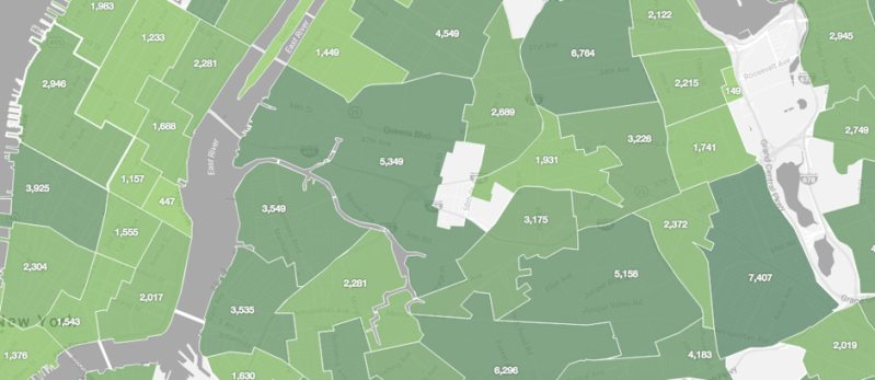
For more than a year, some 2,300 volunteers helped park officials survey more than 685,000 street trees across all five boroughs, gathering stats on species, bark health, trunk width, latitude and longitude, and—this was new—GPS coordinates for every one.
“We’ve got excellent data at the core of this project,” says Jennifer Greenfeld, the park department’s assistant commissioner for forestry, horticulture, and natural resources. These extra-fine-grain details will help the parks department focus its maintenance work as they send out specialists to tend to overgrown or sickly trees, she says.
But Greenfeld is also betting that pinpoint accuracy will get leaf-curious New Yorkers more invested in the state of their living infrastructure. On the interactive map, users can tap in any NYC address for a birds-eye view of the trees on that block, color-coded by genus and shaped to give a relative sense of a trunk’s circumference.
Clicking on a tree-circle opens up a sidebar with a detailed look at the plant’s species, diameter, leaf shape, and a Google Street View window to show its real-world surroundings.
Using data from specialized tree inventory software, the map also estimates the monetary value that tree provides to locals—a quintessentially New York perspective, perhaps. For example, a London Planetree on Halsey Street in Brooklyn intercepts nearly 4,000 gallons of stormwater per year, a service worth $37.
By shading and cooling the block, it also conserves nearly 2,000 kilowatt hours annually, saving New Yorkers more than $250. Yes, money really does grow on trees.
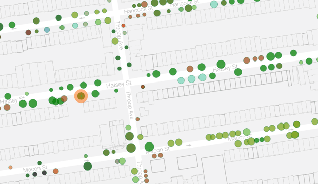
A birds-eye view of street trees in a section of Bed-Stuy. (New York City Street Tree Map )
Map explorers will also find that they can request maintenance for a specific tree, and log personal “tree care” activity within the map—which the Parks Department particularly hopes to encourage. All New Yorkers are free to water, weed, and (of course) pick up litter from street trees themselves; planting flowers in mulch beds is also kosher.
More advanced activities, such as tree pruning, planting, and removal, can also be performed by citizens, as long as they’re got the right permits. The Parks Department offers training for all levels of tree stewardship. “We want to engage people at all tiers of activities and interest,” says Greenfeld.
A handful of New Yorkers, namely the tree census volunteers, are already passionate about urban forestry, and Greenfeld hopes the map will help expand this fanbase. Given that the New York City’s street trees are growing in number—12.5 percent more since the last census in 2005—the parks department needs all hands on deck.
New York City isn’t the only town counting its trees; San Francisco, Los Angeles, Chicago, Washington, D.C. and other cities have conducted similar surveys, and the U.S. Forest Service has a team of scientists focused on inventorying urban canopies.
But the NYC street tree map is a uniquely accessible public-facing tool to come out of such an effort. The Parks Department has been a leader in municipal open data, with special staff and resources dedicated to moving standardized information onto the portal and offering forums that get the public excited about it.
“Our relationship with data reflects what we do in life,” says Greenfeld—meaning that the agency maintains open spaces, intended for use by all. In addition to the tree census and new map, the agency wrapped up its second civic hack-athon earlier this year.
Census results are also available as raw datasets through the NYC OpenData portal, as are previous censuses. (Data-savvy citizen mappers have made impressive use of these resources in the past, such as this gorgeous arboreal atlas.)
When it comes to data transparency and citizen engagement, the Parks Department is certainly starting from an advantage—unlike sanitation or housing or police, Parks is in charge of a resource with which New Yorkers interact in an almost universally positive way. (Who doesn’t love trees?)
Besides handing out green thumbs to citizens, perhaps the work of the Parks Department can be a model to other agencies struggling to even make key datasets public: Imagine a detailed city-built map like this, but for building code violations, or street parking regulations. The public might stand to benefit even more.
Attached link
http://www.citylab.com/design/2016/11/an-encyclopedic-map-of-new-york-citys-street-trees/506492/Media
Taxonomy
- Urban Drainage
- Ecosystem Management
- Climate Change
- Urban Water
- Climate Change Adaptation
- Climate Change Resilience
- Urban Water Supply
- Ecosystem Management