Underground Infrastructure Mapping of Smart Cities
Published on by Water Network Research, Official research team of The Water Network in Technology
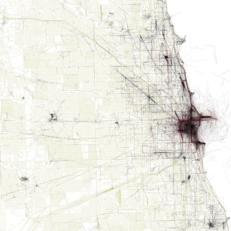
UI Labs from Chicago has a goal to create a unified and integrated map of underground infrastructure, in order to help both government and citizens.
 It’s five minutes into your morning commute, and whether you’re driving, biking, or walking, you can see them in the distance: orange cones, cordoning off large sections of a busy city street.
Within their perimeter are jackhammer-wielding construction crews tearing up the roadway’s surface, snarling traffic for blocks around them.
Sound familiar? For many, the sight is often met with grumbles over a delayed commute or complaints over what seems like never-ending construction.
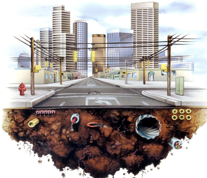
Yet there’s a reason crews are hitting city streets so frequently: under the asphalt lurks a complex maze of water, gas, electric, and telecommunications lines, among other things, that need regular maintenance, repair, and upgrades.
In many cities, this underground infrastructure is decades or even centuries old, and in a constant state of flux. Local governments, along with dozens of private companies, must work together to coordinate these unending street cuts, without any party truly knowing the current layout of what’s underneath the surface at any given time.
Given this underground problem cities face, longer commutes aren’t the only issue for them to contend with, either. According to the American Public Works Association, an underground utility line is hit, on average, every 60 seconds in the United States, costing billions to the national economy.
Collectively, these hits, leaks, and other issues impact construction timelines, public and private budgets, and even worker and resident safety.
The underground problem is a complex one without easy solutions. The referee for this process is generally a city’s transportation or infrastructure department, which issues permits for street cuts or emergency repairs. In a perfect world, each city would be able to issue as few permits as possible — yet in the real world, that just doesn’t happen.
One of the only ways a city agency, utility company, or other player can know how and where to start a project is by carving open the street and seeing what’s underneath. If cities wish to reach that perfect-world goal, having a comprehensive, up-to-date map of the underground would help. Yet the technology, complexity, and scope required for such an undertaking prevents most places from making such work a priority.
In order to develop a solution to the underground problem, cross-sector collaboration is not only beneficial, but necessary. It’s also a problem that University + Industry (UI) Labs, a Chicago-based innovation accelerator that officially opened its doors less than two years ago, was built to tackle.
On September 27, 2016, UI Labs officially announced the development of technology for its Underground Infrastructure Mapping (UIM) Platform, which visually captures below-ground assets so that cities, utility companies, and other players may drastically reduce the time and cost required for street projects.
The platform, currently in its pilot stage, is being actively deployed in Chicago, using a street in the city’s downtown-located River North neighborhood as the testing grounds for the new technology.
“By improving the accuracy of underground infrastructure information, the platform will prevent inefficient and delayed construction projects, accidents, and interruptions of services to citizens,” said Chicago CIO Brenna Berman, one of the project’s top leaders working with UI Labs, during the project’s announcement.
As UI Labs launches one of its biggest urban infrastructure projects to date, the announcement itself is a milestone for the accelerator. It also signifies its unique operational model’s capability to produce a major technological development, with potentially huge implications for cities worldwide.
PUTTING BIG PROBLEMS TO THE TEST
Driven by the City of Chicago, the University of Illinois at Urbana-Champaign, the State of Illinois, and a wide range of academic and corporate partners, UI Labs was designed in part as a research institution in the vein of the old Bell Labs, where the transistor and laser were in part developed.
Its design goes beyond a traditional research center role, though, by serving as a forum for cross-sector collaboration.
 That forum, which consists of two sub-labs under the UI Labs umbrella, currently has over 250 members that span the industrial and tech sectors, local and state government, academic institutions, research centers, and community organizations.
While its structure is complex, the Labs’ goal is straightforward: to develop high-tech, commercially viable solutions that tackle large-scale urban, industrial, and societal challenges through collaboration.
These solutions utilize advanced computing, analytics, and Internet of Things (IoT) technologies.
UI Labs, headquartered on Chicago’s Goose Island, was officially launched in February 2014 with the help of a $70million grant from the U.S. Department of Defense (DOD). That grant helped fund the first sub-lab under the UI Labs title: The Digital Manufacturing and Design Innovation Institute (DMDII), which builds on the region’s industrial strengths to support the digitization of manufacturing technologies.
The second of these labs, launched in early 2015, is City Digital, which serves as the home for UI Labs’ smart cities research and development.
This all brings us back to the underground problem: exactly the kind of major urban infrastructure challenge that UI Labs — and specifically, City Digital — was built for. So how does a consortium the size of UI Labs start with such a broad challenge, and finish with the focused development of a specific technology?
“Our job, first and foremost, is to serve as conveners,” said Steve Fifita, City Digital’s Executive Director. “We specialize in identifying problems together at summits and workshops with city stakeholders, corporations, and subject matter experts, and then help determine who’s best equipped to address them.”
During these annually-held summits, City Digital and its partners identify several dozen large-scale problems that current technologies don’t have an answer for. Once these critical areas are identified and prioritized, smaller groups, generally consisting of four to eight partners, emerge to take on these challenges. Within each group, each partner takes on a role unique to their organization.
It’s here where when those innovative cross-sector solutions get developed. An engineering firm and/or university, for example, may take on the R&D needed for a new form of hardware, while a tech firm may design accompanying software or provide the project with computing capacity. From there, City Digital moves forward with local government to help test the viability of what’s being developed via a pilot, using the City of Chicago as its real-world grounds for experimentation.
“Being able to pilot these projects within Chicago’s urban environment is critical to our process,” noted Fifita. “The City really goes above and beyond to ensure that it’s open for such innovative work.”
Real-world experimentation also allows City Digital to help ensure that the technologies its teams develop not only work, but have a demonstrable market value and a viable business model. This feature, combined with corporate and academic expertise, is what makes the City Digital process at UI Labs unique.
Read full article at: Data-Smart City Solutions
Media
Taxonomy
- Technology
- Smart City
- Infrastructure
- Landscape & Urban Design
- Infrastructure
- Software Solutions
- Data Management