Satellites Help Fight Drought in Ethiopia
Published on by Getachew H/Michael, WASH M&E specialist (Knowledge Management) at UNICEF-Ethiopia (A.A.) in Technology
With Ethiopia threatened by a potentially devastating new drought, UNICEF has ventured into an area for which the Children’s Fund isn’t generally known: Satellite remote sensing.
The technology is being used to help herders drill the wells they need to keep their thirsty flocks alive. More than 70 percent of the wells drilled in the arid Afar region of north-eastern Ethiopia have gone dry during the latest drought because they weren’t dug in the most useful place.
The new technology will make sure that wells are best situated to take advantage of available fresh water.
More than 70 percent of the wells drilled in the arid Afar region of northeastern Ethiopia have gone dry during the latest drought because they weren’t dug in the most useful place. The new technology will make sure that wells are best situated to take advantage of available fresh water.

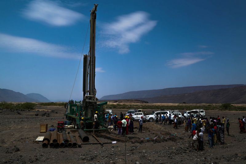
Launching the mini-village water scheme project north of Samera in Ethiopia
UNICEF Ethiopia/ 2015/Tesfaye
The world focused on the Horn of Africa during the 2011 drought crisis that affected 13 million people across Ethiopia, Somalia and Kenya, but four years later, attention has dissipated, and a lack of seasonal rain means a new drought looms.
Ethiopia is a victim of its geographic and climactic location and prone to periodic droughts, but experts are predicting the latest one could be the worst in decades—producing devastating effects on food security in the country for the next two years.
One of the most affected areas in the country is the Afar Region in the Great Rift Valley where daily temperatures can exceed 44 degrees Celsius and there is less than 300mm of rain annually.
Most of the Afar region’s population of 1.5 million people survive mainly on herding (92 percent), and the animals need water. Water the existing wells aren’t providing.
This is where satellites come in. UNICEF analyzes information the satellites provide on ground vegetation, topology and morphology, combined with hydro-geological information on the region, and pinpoints the best place to drill wells.

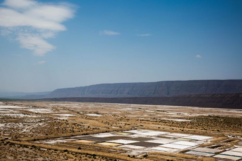
A salt farm in Ethiopia. More than 1.2 million Ethiopians are affected by water shortages in September 2015. More than 50 percent of this population are women and children.
©UNICEF Ethiopia/2015/Sewunet
Just 84 km north of Afar’s capital of Samera, UNICEF put its remote sensing satellite plan into action. The government identified the district of Elidar as a priority location—shepherds head there due to water shortages elsewhere.
Currently, people rely on expensive commercial trucks to haul in water because most of the water found by digging wells is very salty. Deep underground, however, lies fresh water, and the UNICEF-directed remote sensing investigations have found just the right places to drill boreholes down between 250 and 300 metres.
Three boreholes will be drilled by end December 2015. These wells will provide more than 100,000 people with access to safe water. A contract has been awarded to a private drilling contractor at a cost of 9 million birr (US$ 433,264), and UNICEF will supervise the works with the local water bureau.
As a water engineer, being able to put science into action in this manner and help communities and their livestock is very rewarding for me.
UNICEF is providing high end scientific and technological support to access deep groundwater in a geologically complex area of Ethiopia, reducing dependence on expensive trucked in water.
“This essential work by UNICEF is providing lifesaving water to needy children and women in this pastoralist area of Afar,” said UNICEF Representative to Ethiopia Ms. Gillian Mellsop, during visit to the site with State Minister of Water, Irrigation and Energy Dr. Kebede Gerba.
“Previously this population was dependent on the unsustainable and costly water from water trucks. Now, women and children will have access to water year round,” she added.
This article is blogged previously
Read full article in the attachment
Media
Taxonomy
- Resource Management
- Water Access
- Water Resource Management
- Technology
- GIS
- Access
- Hydrologist
- GIS & Remote Sensing