How Nasa's Satellites Can Help Solve The Middle East Water Crisis
Published on by Water Network Research, Official research team of The Water Network in Academic
NASA can use satellite images to identify suitable water and places with the right soil for agriculture.
Desperate to head off a regional water crisis, these scientists have pinned their hopes on U.S. satellite imagery to boost water efficiency and sniff out additional water resources.
Farouk El-Baz, director of the Center for Remote Sensing at Boston University, an adviser to Egypt’s president and a longtime NASA scientist says “If we can use satellite images to identify suitable water and places with the right soil for agriculture, then we’d be very, very stupid not to use it.” Aquifers in the Arabian Peninsula are so tapped out that some countries—notably Saudi Arabia—have had to drop much of their agriculture.
Nowhere has this technology proved more valuable than in the Middle East.
Authorities in Jordan weren’t even sure what their farmers were growing until satellite imagery enabled them to build aerial crop maps. They’ve since cracked down on the cultivation of water-intensive plants, like rice. In Lebanon, where a dysfunctional political system has hampered data collection (there hasn’t been a census since the 1930s for fear of upsetting the sectarian balance), satellite imagery has allowed officials to make up the shortfall in information on everything from urban planning to abuse of the food subsidy system.
After analyzing the country’s farmland from above, the National Council for Scientific Research (CNRS) worked out that farmers were growing roughly half the 20,000 hectares of wheat that they’d claimed. The government was subsequently able to slash its wheat subsidy handouts by over two-thirds.
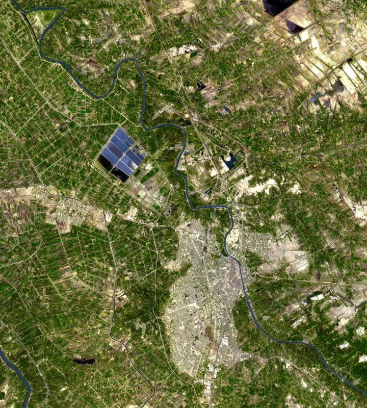
Image: NASA Terra spacecraft captured this image north of the present town of Al Hillal , Iraq, in the fertile plain between the Tigris and the Euphrates Rivers, where the site of the legendary city of Babylon lies.
But it’s space technology’s capacity to better regulate water usage, and therefore grow more food with fewer resources, that’s really excited the science community.
By gauging the temperature of a field, which if irrigated properly should be below that of the surrounding area, researchers can determine if a crop is water-stressed or, crucially in the Middle East, consuming more water than it needs.
Through measuring the amount of moisture in tree canopies and snow melts, they can learn how much water they’ll have to toy with in the first place. “It enables us to make better predictions, to learn how much irrigation will be needed, to see if a country is in a state of drought,” says Rachael McDonnell, head of the climate change modeling adaptation section at the Dubai-based International Center for Biosaline Agriculture (ICBA), which frequently partners with NASA.
Unfortunately, the Middle East, already the world’s driest region, appears to be getting even drier. And so satellite imagery might really come into its own in the bleakest of circumstances.
Using NASA’s Landsat program—“the Land Rover Defender of the data world,” McDonnell calls it—aid organizations have created drought and famine early-warning systems, through which they try to tackle crises before they worsen.
They scan images for signs of desertification and look for indications of widespread vegetation stress. When Morocco was struck by a severe drought last year, which cut grain production by almost 60 percent and led to the loss of almost 200,000 agricultural jobs, remote-sensing analysts took the lead in pinpointing and directing assistance to the worst-affected areas.
Still, satellite imagery’s rollout hasn’t been without its problems, in large part because many governments have yet to recognize the technology’s importance. On many occasions, quality research and useful data never reach policymakers, instead gathering dust on bureaucrats’ desks.
“One of the big problems in the entire Arab region is that we can do the science, but a lot of it’s just thrown in a drawer,” says Chadi Abdallah, a researcher at Lebanon’s CNRS. In other instances, underappreciated national science institutes have been among the first to lose their funding during economic crises. Egypt’s lone science satellite, NileSat, is out of operation for financial reasons; Iraq’s science and technology budget has been eviscerated. No manner of high-resolution data from the sky can help when there’s no one on the books to interpret the often complicated raw information.
Source: Newsweek
Media
Taxonomy
- Agriculture
- Sustainable Agriculture
- Water Scarcity
- GIS & Remote Sensing Technology
- GIS
- GIS for network
- Water Security
- Agriculture & Forestry
- GIS & Remote Sensing
- Satellite
1 Comment
-
Interesting!