USGS Prepares to Measure Flooding Across Arizona
Published on by Water Network Research, Official research team of The Water Network in Academic
U.S. Geological Survey field crews are preparing to measure potential flooding across Arizona as remnants of Hurricane Rosa move across the state.
The National Weather Service has issued a flash flood watch for central and western Arizona through 5 a.m. on Wednesday.
USGS real-time maps of flood and high flow conditions for Arizona may be accessed online.

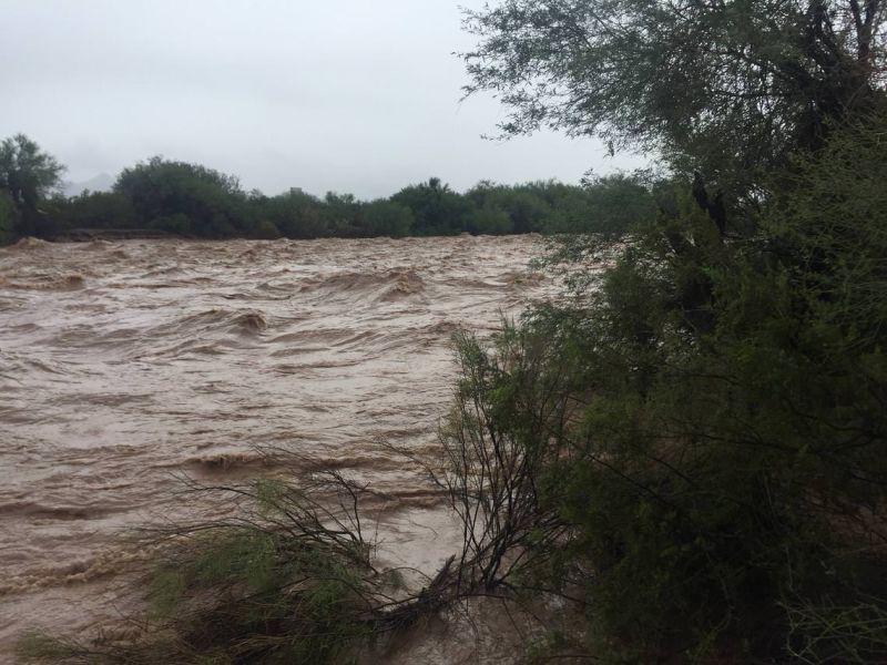
Flooding at Vekol Wash today, south of Phoenix, following remnant rains from Hurricane Rosa. (Credit: USGS. Public domain.)
If flooding occurs, USGS crews will go out in the field to measure floodwaters and verify streamgage operations. This information is critical for resource managers and emergency responders to help protect life and property. These data are used by the National Weather Service to develop flood forecasts, the U.S. Army Corps of Engineers to manage flood control, county flood control districts, and other local agencies in their flood response activities.
There are about 225 USGS-operated streamgages in Arizona that measure water levels, streamflow, and rainfall. When flooding occurs, USGS crews make numerous flood measurements to verify the data USGS provides to federal, state, and local agencies, as well as to the public.
For more than 125 years, the USGS has monitored flow in selected streams and rivers across the U.S. The information is routinely used for water supply and management, monitoring floods and droughts, bridge and road design, determination of flood risk, and for many recreational activities.
Learn more about how the USGS Arizona Water Science Center has been preparing to accurately measure flooding well before the rain hits by viewing this video.
Access current flood and high flow conditions across the country by visiting the USGS WaterWatch website. Receive instant, customized updates about water conditions in your area via text message or email by signing up for USGS WaterAlert. View water data on your mobile device.
Source: USGS
Media
Taxonomy
- River Studies
- River Engineering
- Flood management
- Flood damage
- Flood prediction
- River Engineering
- Flood Risk Management
- Flood Modeling