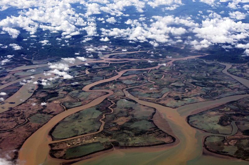
‘Backwater’ effects may boost flooding in Ganges Delta
Published on by Ashantha Goonetilleke, Professor, Water/Environmental Engineering at Queensland University of Technology in Academic
As climate change continues, storm surges and sea-level rise are both expected to play a greater role in flooding by increasing the chances of water being pushed back upstream. A new river flow model reveals how these"backwater" effects and other local-scale phenomena will affect the distribution of flood damage across the vast Ganges–Brahmaputra–Meghna Delta in South Asia.
When a river floods, the directions in which it spills are not always obvious. Sometimes the water splits into two flows and on other occasions it may take an unexpected short-cut downhill. If there is pressure from downstream, in the form of a storm surge or sea-level rise, the water may travel back upstream, bringing floods from a seemingly unlikely direction.
When scientists want to understand flooding on continental-scale rivers such as the Ganges–Brahmaputra–Meghna Delta, they have to consider basin-wide water balancing over thousands of kilometres as well as detailed topography such as channels, levees and floodplains at scales of less than 100 m. "Because of these multiple scales it is very difficult to model continental-scale river floods," said Yukiko Hirabayashi, from the University of Tokyo in Japan.
To overcome this issue, Dai Yamazaki from the Japan Agency for Marine-Earth Science and Technology has developed a global-scale river hydrodynamic model that uses sub-grid-scale parameters to represent localized water movement. Hiroaki Ikeuchi from the University of Tokyo applied the model, called "CaMa-Flood", to look at future flood hazards on the world's largest mega delta region – the Ganges–Brahmaputra–Meghna Delta.
The model showed that floodwater in the main channels flows into tributaries via splitting channels (bifurcation), resulting in an increase in flood depth in deltaic regions. The researchers also found that in future large upstream areas lying far from the river mouth will experience increased flooding due to sea-level rise preventing water from flowing downstream as fast as it does currently. "This backwater effect from sea-level rise heightens the floodwater level and increases the flood inundation area from downstream to middle basins," said Ikeuchi.
Climate models indicate that flood risk is likely to increase by between 50 and 100% in the Ganges–Brahmaputra–Meghna Delta by the end of this century, depending on the global emissions over the next few decades. Using their new model, Ikeuchi and his colleagues showed that when the "backwater effect" and channel bifurcation are considered, the flood risk by the end of this century is even higher than anticipated.
"Future flood risk is underestimated by 5% if we don't consider the impact of the backwater effect from sea-level rise, and 15% if channel bifurcation isn't considered," said Ikeuchi. The findings are published in Environmental Research Letters (ERL).
Although it will be hard to slow the juggernaut of climate change, models like this can help communities to be better prepared for the future. "Local water management agencies can use this information to assess the probability of high water in different basins and design better flood protection infrastructure," said Hirabayashi.
And it isn't just the Ganges–Brahmaputra–Meghna Delta that could benefit. Hirabayashi now hopes to apply the model to other deltaic rivers such as the Irrawaddy, Mekong and Niger.
Attached link
http://environmentalresearchweb.org/cws/article/news/64435Taxonomy
- River Basin management
- Flood