DamSite: an Automated Tool for Dam Site Selection and Economics
Published on by Water Network Research, Official research team of The Water Network in Technology
An automated and rapid method for identifying dam wall locations and estimating reservoir yield over large areas.
Dr Petheram and colleagues have created DamSite - DamSite is a program that automates both the identification of all suitable dam locations within a region, and then quickly calculates reservoir dimensions for individual dam sites.

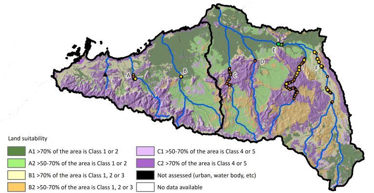
DamSite rapidly analyses potential dam locations to find the most economical solution. Image source: Cuan Petheran.
The program uses a series of algorithms that identify and rank potential dam wall locations across a landscape. Rankings are based on calculations of reservoir dimensions to predict yield, and reliability within a landscape. The result is a rigorous and consistently applied model to evaluate individual dam sites for suitability and deliverability. Using the wall locations, a digital elevation model, and hydrologic regime, the yield and reliability can be calculated.
The model was run across 3 million km2 of northern Australia in support of the recent Northern Australia White Paper (Northern rivers and dams: A preliminary assessment of surface water storage potential for northern Australia). More than 2 billion potential dam sites were recognised and assessed.
Petheram notes they have recently made some big improvements since the white paper, including using Landsat imagery to create a raster of river thickness, from which they can then calculate spillway width. Using this information helps them estimate the flood rise for a significant flood event, which is an important consideration in costing a dam. These improvements will also soon be submitted for publication. Those interested in using the DamSite model should contact Cuan Petheram (Cuan.Petheram@csiro.au).
Read full article: Spatial Source
Access paper: Science Direct
Media
Taxonomy
- GIS & Remote Sensing Technology
- GIS
- River Studies
- River Engineering
- Dams
- River Engineering
- Hydrogeologist
- GIS & Remote Sensing