Did Ancient Irrigation Technology Travel Silk Road? Drones May Have the Answer
Published on by Water Network Research, Official research team of The Water Network in Academic
Using satellite imaging and drone reconnaissance, archaeologists from Washington University in St. Louis have discovered an ancient irrigation system that allowed a farming community in arid northwestern China to raise livestock and cultivate crops in one of the world’s driest desert climates.
Lost for centuries in the barren foothills of China’s Tian Shan Mountains, the ancient farming community remains hidden in plain sight — appearing little more than an odd scattering of round boulders and sandy ruts when viewed from the ground.
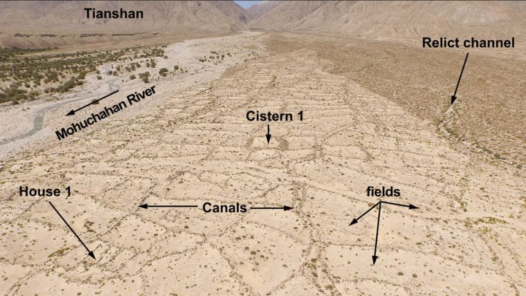 Aerial view of an ancient irrigation system discovered in the foothills of Xinjiang, China. (Image: Courtesy of Archaeological Research in Asia), via: WUSTL
Surveyed from 30 meters above using drones and specialized image analysis software, the site shows the unmistakable outlines of check dams, irrigation canals and cisterns feeding a patchwork of small farm fields. Initial test excavations also confirm the locations of scattered farmhouses and grave sites, said Yuqi Li, a doctoral student in the Department of Anthropology in Arts & Sciences who discovered the site with grant support from the National Geographic Society.
Preliminary analysis, as detailed by Li and co-authors in the December issue of the journal Archaeological Research in Asia, suggests that the irrigation system was built in the 3rd or 4th century A.D. by local herding communities looking to add more crop cultivation to their mix of food and livestock production.
“As research on ancient crop exchanges along the Silk Road matures, archaeologists should investigate not only the crops themselves, but also the suite of technologies, such as irrigation, that would have enabled ‘agropastoralists’ to diversify their economies,” Li said.
“In recent years, more and more archaeologists started to realize that most of the so-called pastoralist/nomad communities in ancient Central Asia were also involved in agriculture,” Li added. “We think it’s more accurate to call them agropastoralists, because having an agricultural component in their economy was a normal phenomenon instead of a transitional condition.”
Working with The Spatial Analysis, Interpretation, and Exploration (SAIE) laboratory at Washington University, Li and colleagues first used satellite imagery to target an area known as MGK, so named for the adjacent Mohuchahan Valley, an intermontane valley of the Tian Shan.
More detailed on-site mapping was accomplished using a consumer-grade quadcopter drone and new photogrammetry software that stitched together about 2,000 geotagged aerial photos to create 3D models of the site.
The site provides researchers with a remarkably well-preserved example of a small-scale irrigation system that early farmers devised to grow grain crops in a climate that historically receives less than 3 inches (66 millimeters ) of annual rainfall — about one-fifth of the water deemed necessary to cultivate even the most drought-tolerant strains of millet.
Researchers believe the site was used to cultivate millet, barley, wheat and perhaps grapes.
Read full article: WUSTL
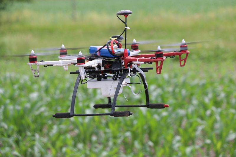
Drone, representative image, source: Max Pixel
Media
Taxonomy
- Agriculture
- Irrigation
- GIS & Remote Sensing Technology
- GIS
- GIS for network
- Agriculture
- Water
- Water
- GIS & Remote Sensing
- Irrigation and Drainage