GPS Tracking Reveals How Litter Travels through Suburban Waterways around Melbourne
Published on by Water Network Research, Official research team of The Water Network in Technology
In a Victorian-first citizen science project, GPS-tracked bottles will be released in suburban waterways around Melbourne to reveal precisely how litter makes its way from our streets to our beaches.
A staggering 95% of the litter on Port Phillip Bay beaches comes from suburban streets, with about 350,000 cigarette butts washing into the bay every year.
The Litter Trackers project will see RMIT University scientists working with schools and community groups to deploy 100 GPS-tracked bottles in 20 locations across Melbourne’s catchments.
Online interactive maps allow anyone to follow the bottles and discover just how rapidly litter travels through our waterways.

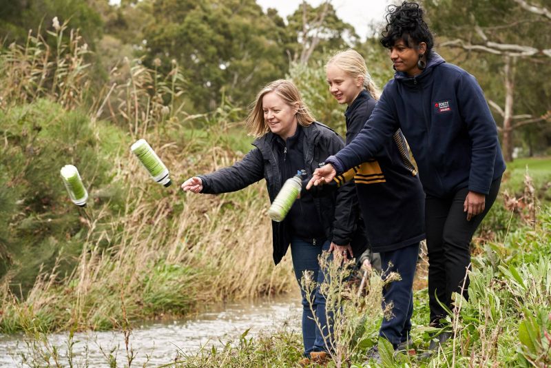
Melbourne Water’s Litter and Waterwatch Coordinator Naomi Dart, citizen scientist and Bentleigh West Primary School student Sophie Littlefair and RMIT’s Dr Kavitha Chinathamby launching GPS-tracked bottles into Dandenong Creek. (Image source: rmit.edu.au)
Project leader Dr Kavitha Chinathamby said Litter Trackers gives all of Melbourne a chance to see the true environmental scale of our litter problem and shows how we can all be part of the solution.
“From cigarette butts to plastic bottles, the litter we drop on our streets finds its way into our waterways and washes up on our beaches,” Chinathamby said.
“Litter reduces water quality, harms fish and animals, and ruins our city’s natural beauty.
“To build a more sustainable and liveable future for Melbourne, we need healthy waterways – and that means we need to tackle our litter problem at the source.
“Through Litter Trackers, everyone can get on board with driving this change and create a cleaner, healthier future for our waterways and bays.”

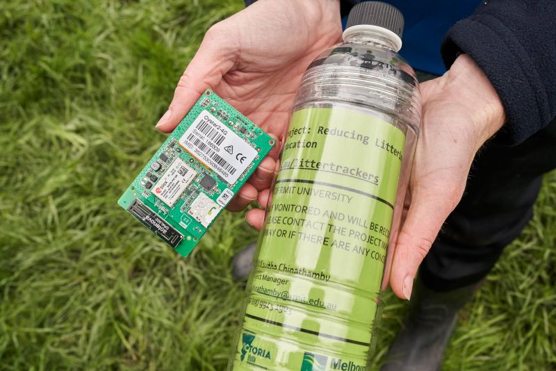
Each of the 100 bottles being released is fitted with a GPS tracker. (Image source: rmit.edu.au)
Litter Trackers is a collaborative project between RMIT and Melbourne Water , supported by the Victorian Government.
The project is the first of its kind for Victoria, and only the second time that litter has been GPS-tracked in Australian waterways. Melbourne Water’s Litter and Waterwatch Coordinator Naomi Dart says Litter Trackers is a terrific learning tool for students and the wider community.
“People often don’t realise that the rubbish they drop in their suburban street ends up right here in our rivers and streams carried by stormwater through our waterways. The Litter Tracker technology shows us this in real time,” Dart said.
“Melbourne Water spends millions of dollars a year removing litter from our waterways. This project is an important reminder for everyone to bin their litter.”
As part of the project, classroom materials and teacher resources will be developed to educate school children about littering and its environmental impacts.
The Litter Trackers initiative is led by RMIT’s Aquatic Environmental Stress research group (AQUEST). AQUEST works with schools, community groups, government and industry partners to support healthy waterways across Melbourne, through the development of innovative approaches to preventing and cleaning up pollution from our rivers, creeks and bays.
Read more about this project on RMIT
Media
Taxonomy
- Contaminant Movement Mapping
- GPS