How NASA's Satellite Launch will Improve Understanding of Rising Sea Levels
Published on by Water Network Research, Official research team of The Water Network in Academic
Shortly before dawn on Saturday, NASA is set to launch ICESat-2, a satellite that will use a laser to measure the changing height of Earth’s ice.
![]() Scientists are trying to understand how frozen and icy areas — known as the cryosphere — are being affected by the warming of the planet.
Scientists are trying to understand how frozen and icy areas — known as the cryosphere — are being affected by the warming of the planet.
The satellite will be carried into space by a Delta rocket scheduled to lift off from Vandenberg Air Force Base in California. Helen Fricker, a glaciologist at UC San Diego’s Scripps Institution of Oceanography who has long been part of the mission’s science team, explains the project.
Why is this mission important?
ICESat-2 is a laser mission that is going to orbit the Earth in three-month periods. By doing that you can, over time, build up a picture of where the Earth’s mass is being redistributed.
We are concerned that the sheets are melting, raising the level of the ocean.
We don’t know to what extent this is happening because it is very difficult to monitor Antarctica and Greenland; they’re so vast. The only way you can do this is with a satellite. You need to routinely map.
If you could drive around Antarctica it would take millions of people doing that all of the time to get the kind of data we’ll get from ICESat-2. And Antarctica is so remote and hostile. It’s not even worth thinking about.
I know people in California think [ice melt in] Antarctica is not an issue because it is so far away. But sea level rise will affect us here. It will eventually make its way to the West Coast. We will see the effects of Antarctica and Greenland melting.
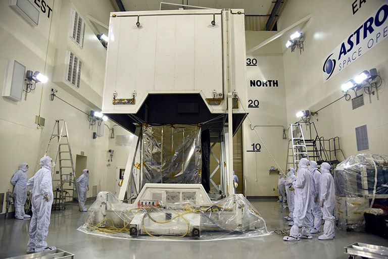
NASA’s Ice, Cloud and land Elevation Satellite-2 (ICESat-2) spacecraft arrives at the Astrotech Space Operations facility at Vandenberg Air Force Base in California ahead of its scheduled launch on Sept. 15, 2018. Credit: U.S. Air Force/Vanessa Valentine
As it goes around the Earth, will the satellite show that some glaciers are getting bigger and some are getting smaller? Will the water level be higher?
The satellite will fire a laser that measures the height of the ice. With very simple geometry you can convert height into volume and convert volume into mass. Going from that simple measurement, you can figure out how much mass is going into the ocean.
ICESat-2 focuses a small laser beam on the ground, which lets us track individual glaciers and outlet glaciers to see how they’re changing. We will be able to see if ice has been lost. The reason ICESat-2 is so powerful is that you can look all of the time.
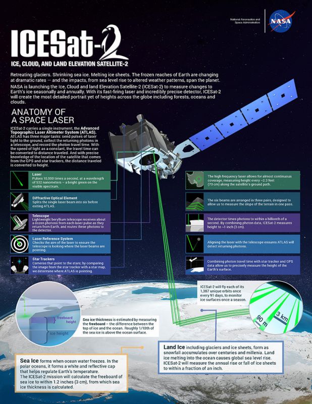
NASA’s Ice, Cloud and land Elevation Satellite-2 (ICESat-2) will measure height with a laser instrument that features components designed to provide precise data. Credit: NASA/Adriana Manrique Gutierrez
Is it possible that you will see significant change that occurred over a comparatively short period of time?
In some parts of Antarctica and Greenland, yes, there will be large changes. We do know [from earlier missions] that there are some very large losses occurring. We expect that those will continue.
How will you transform what you learn into policy in a reasonable amount of time?
The most important thing that we’re contributing to the policy is modeling. We use very sophisticated ice sheet models that are coupled with ocean models. It’s a huge mathematical program that tells us how the Earth is going to behave in the future.
The ice sheets are just one component of that. If we can understand them sufficiently, that will improve the projections of sea level rise.
Sources: Los Angeles Times and NASA Goddard
Source for images: NASA
Attached link
http://www.youtube.com/embed/rOXjuiQ3R_oMedia
Taxonomy
- GIS & Remote Sensing Technology
- GIS
- Environment
- GIS & Remote Sensing