Monitoring Harmful Algal Blooms with GIS and Remote Sensing (VIDEO)
Published by Water Network Research, Official research team of The Water Network in Technology
Learn about the causes of Harmful Algal Blooms, how to identify and reduce nutrient loads, and how remote sensing and GIS are being used to study the problem and educate the public.
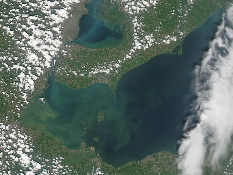
A 2011 LandSat image shows the green scum signaling the worst algae bloom in Lake Erie
Source: NASA, Labeled for reuse
Speakers include:
Mandy Razzano , Environmental Specialist at Ohio EPA Northeast District, will discuss the impact of harmful algal blooms, OEPA’s inland lake program, and how Landsat imagery can be used for remote sensing of chlorophyll levels in lake water.
Dean Barbo , Project Manager at Civil and Environmental Consultants, will discuss the interactive Nutrient Source Inventory developed for Lucas County. The inventory identifies causes of impairment and pollutant sources that need to be controlled to achieve desired nutrient load reductions and reduce harmful algal blooms in the Western Lake Erie Basin. An interactive user-friendly GIS-based mapping tool will be linked to the Lucas County and City of Toledo websites to make the information available for public use.
Dr. Rafat Ansari , Senior Scientist at NASA Glenn, has spearheaded a citizen science campaign to involve public volunteers to monitor water quality along Lake Erie’s coastline and interior waterways. With GPS-enabled cameras mounted on the underside of a small aircraft’s wings, volunteer pilots fly along the coastline of Lake Erie collecting infrared and color images. These images will provide the data that could lead to predicting changes in water quality. The images are available free of charge and hosted online by Cleveland State University. Dr. Ansari will also discuss implementing a local monitoring program.
Tags
Category: Technology
- Decontamination
- Resource Management
- GIS & Remote Sensing Technology
- GIS
- GIS for network
- Algae
- Contaminant Movement Mapping
- Lake Management