Satellite Data Ensures Smooth Flow of Water Resources
Published on by Water Network Research, Official research team of The Water Network in Technology
The MOSES platform puts earth observation data from satellites and cutting-edge forecasting technology at the fingertips of water authorities and agencies, helping them to make informed decisions on procuring and managing supplies.
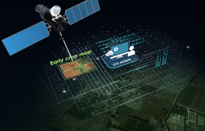
The main objective of MOSES is to put in place and demonstrate at the real scale of application an information platform devoted to water procurement and management agencies to facilitate planning of irrigation water resource. (Image Source: MOSES promotional video print screen)
This gives water authority managers, research institutions and the like the knowledge to minimize drought risks, reduce unnecessary water consumption and supply farmers with exactly what they need for their crops; a hugely important task given that agriculture is one of the largest water-consuming sectors.
“The project came about partly in response to the challenges posed by climate change,” explains the EU-funded MOSES (Managing crop water Saving with Enterprise Services) project coordinator Dr Alessandro di Felice from ESRI in Italy. “Everyone involved in agriculture is aware that this phenomenon exists; for example, we’ve recently seen droughts in Italy and floods in Romania. We wanted to develop a support tool that addresses these kinds of problems that increasingly arise seasonally.”
Better water management
The online platform brings together mapping and geographic information system (GIS) technologies as well as seasonal and in-season weather forecasts, which deliver strategic information both before the irrigation season - in March and April – and during the irrigation season. Being able to better plan water procurement and allocation before the start of the irrigation season would help to mitigate against water shortages, while continuous in-season monitoring of crop water requirements would enable suppliers to adjust their allocation plans throughout the growing season.
After the irrigation season, the system’s forecasts can be compared to what actually occurred, together with an analysis of water and cost savings made. This can help in planning water procurement and allocation before the next irrigation season and provide advice to farmers about water shortage risks.
“Procurement and distribution agencies have typically distributed constant volumes of water with little variability,” notes project partner Dr Giulia Villani from Agromet in Italy. “Climate change, however, has had a dramatic effect, with huge variabilities in precipitation and temperature. In Northern Italy in 2014, for example, we had a very wet summer and thus a decrease in irrigation volumes, while 2017 was extremely dry. This platform makes available valuable information on whether certain areas will need more or less water than average.”
Avoiding crises
During the project, four demonstration areas were set up in Italy, Spain, Romania and Morocco. Different water procurement and distribution scenarios were considered along with user needs and the possible incorporation of existing local services. In the Italian test case for example, water is delivered either through pressurized irrigation systems or through channels. The tool enabled authorities to estimate irrigation water needs at the district level by providing drought indicators and weather information and highlighting potential technical issues such as black-out risks.
The tool was shown to effectively support agriculture water use efficiency, water resource monitoring and flood and drought risk management. “Another positive result was that the end users involved asked for the pilot projects to be expanded,” says project partner Dr Maria Gabriella Scarpino from SERCO in Italy. “This shows that the system has been seen to be useful. Although it is a little early to say, we think that, in the areas where we have been working, approaches to irrigation water use will have to change.”
While project partners are continuing to use the prototype platform, there are plans to expand operations through a third party. “This would be an expert in the water management sector, who would provide the service to end users such as water management agencies, reclamation consortia and farming associations through a web app,” explains Dr di Felice.
The online platform has been designed to be flexible and adaptable and is capable of including new features and GIS products related to Copernicus, the EU’s earth observation satellite system. These might include more high-resolution optical imagery for land agriculture or more accurate land-surface temperature measurements. Europe must make better use of its water resources if it is to achieve its sustainable development goals, and the MOSES platform offers a practical tool to help meet these targets.
Source: Cordis EU
Media
Taxonomy
- Water Management & Security
- Water Resource Mapping
- GIS & Remote Sensing Technology
- GIS
- Geospatial Information Systems
- GIS for network
- Contaminant Movement Mapping
- Water Management
- Water Resource Management
- Groundwater Mapping
- Geographical Information Systems
- Water Resources Management
- Water Resources Management
- Geographical Information System
- GIS Spatial Analysis
- Geographic Information Systems
- Information Systems
- GIS & Remote Sensing
- Satellite
- Irrigation & Water Management
- application of GIS and RS
- GIS Manager