Small Aircraft to Find Water Leakage
Published on by Water Network Research, Official research team of The Water Network in Technology
In about half of the EU countries, more than 20% of clean drinking water is lost in the distribution network before it reaches consumers’ taps, and in some countries the proportion is as high as 60%, stated a report by the European Commission.
Often, old piping systems and poor water pressure management are to blame.
By Sorina Buzatu
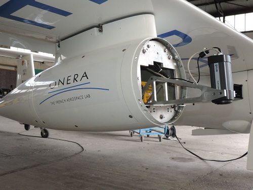
Sensors on a motor-glider - Credits: ONERA
It seems to be quite difficult to measure the precise quantity of water lost every day. According to the calculations made in 2016 by the non-profit initiative European Benchmarking Co-operation (EBC), utilities in 20 participating countries (17 from Europe, together with Oman, Republic of Singapore and United States) face distribution losses up to 66.4m3 per km per day.
Many leaks go undetected because they are not visible on the surface. Now a new technology is being developed to improve the inspection of pipes. This method consists in taking pictures with remote sensing cameras, mounted on a small plane or an unmanned aerial vehicle (UAV). The images recorded in different spectral bands, from the visible to the short wave infrared and in the thermal infrared band, are then interpreted in labs.
“The main information is obtained in the thermal infrared band. Leaks will be detected through changes in the near environment, essentially through the increased soil moisture and maybe through changes in vegetation,” Jean-Claude Krapez, senior research scientist at the French Aerospace Lab ONERA, based in Provence, told youris.com.
He added that one camera actually monitors the thermal radiation emitted by the soil. “Compared to dry areas, wet areas are subject of latent heat exchange with the atmosphere, resulting in a cooling of the surface. This is seen in our images, as darker areas, which are correlated to lower temperature,” Krapez went on. Nevertheless, the thermal radiation level depends not only on temperature, but also on the earth’s surface material, either soil, or rocks, and on the vegetation present.
The research is being conducted as part of the European project WADI and several tests have so far been undertaken in the Provence region in the south of France, using on-board cameras on a small aircraft. Further surveys are envisaged with smaller cameras installed on an unmanned aerial vehicle provided by Galileo Geosystem.
“Both camera systems will work at approximately the same resolution, they will collect the optical signals in nearly the same bands, so we expect the images to be quite similar. With our aircraft we can inspect more linear systems, such as long pipes running for several kilometres, while with the UAV we will inspect more complex networks with many branches and short lines,” said Krapez.
Tens of kilometres of rural land can be surveyed by aircraft equipped with on-board cameras. “It can be different types of water transportation means, either underground, pressurised pipelines or open air canals, drinking water pipelines or water transportation for irrigation,” explained Krapez.
However, some challenges remain when it comes to images interpretation, due to the high heterogeneity of the surface: bare soils, low grass, meadows, crops, bushes, high trees.
Read full article: Youris
Media
Taxonomy
- Technology
- GIS & Remote Sensing Technology
- GIS
- Leakage Detection
- Leakage
- Infrastructure
- Leakage Reduction
- Integrated Infrastructure
- Infrastructure Management
- GIS Spatial Analysis
- GIS & Remote Sensing
- green infrastructure
- Pipes and Pipelines