The Veins of America: Stunning Map Shows Every River Basin in the US
Published on by Water Network Research, Official research team of The Water Network in Social
Created by Imgur user Fejetlenfej, a geographer and GIS analyst with a ‘lifelong passion for beautiful maps’ highlights the massive expanse of river basins across the country.
As he states on his Imgur page, this is a high-resolution map of all the permanent and temporary streams and rivers of the contiguous 48 states in beautiful rainbow colors, divided into catchment areas. It shows the Strahler Stream Order Classification. The higher the stream order, the thicker the line.
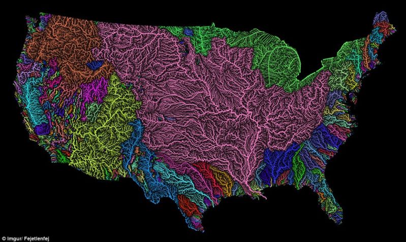
The map is made mostly with the open-source QGIS software. Visit the link below to find more detailed images.
Attached link
https://www.reeldealanglers.com/the-veins-of-america-stunning-map-shows-every-river-basin-in-the-us/Media
Taxonomy
- Water Resource Mapping
- GIS & Remote Sensing Technology
- GIS
- River Studies
- GIS & Remote Sensing