Tracking River Flows from Space
Published on by Water Network Research, Official research team of The Water Network in Academic
The Surface Water and Ocean Topography (SWOT) satellite mission aims to change how we assess freshwater export from rivers.
One mission objective explores a novel alternative approach that uses remote sensing data to estimate river fluxes.
By Colin J. Gleason, Pierre-André Garambois, and Michael T. Durand
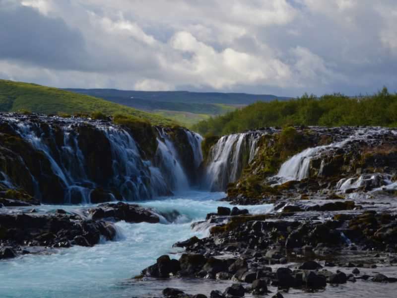
Brúarfoss (Bridge Falls) near Reykholt, Iceland, attracts tourists and locals alike for weekend picnics and sightseeing. McFLI calculations can provide valuable information for use in making water management decisions for societal benefit. Credit: C. J. Gleason
The Surface Water and Ocean Topography is jointly developed by NASA, France’s Centre National d’Etudes Spatiales (CNES), the Canadian Space Agency, and the UK Space Agency and scheduled for launch in 2021,
The essence of our idea is simple: We use satellite observations of rivers, and we apply basic flow laws and the principle of mass conservation to work out what a river’s discharge must have been to produce the observations. We refer to methods that take this approach as mass-conserved flow law inversion (McFLI) techniques.
Why Use McFLI ?
The total amount of water on the planet measures to about 1.4 billion cubic kilometers, of which less than 1% is accessible freshwater [Margulis, 2016]. But we have a difficult time tracking the flux, or discharge, of water as it winds through rivers globally.
Hydrologists have been tracking river fluxes for decades using gauging stations, field instruments that record river depth and convert it to flux through an empirically calibrated rating curve. These stations are highly accurate, but they are expensive to install and maintain, and the supply of publicly available data is in decline in some parts of the world for economic and political reasons [Hannah et al., 2011].
An approach like McFLI, which is indirect but based on physical flow laws, is needed because it is nearly impossible to directly measure river discharge remotely. Planes and satellites have an extremely difficult time seeing the bottom of a river through deep or murky water [ Legleiter et al., 2009].
But they can measure river width, surface height, and slope and how they change over time. McFLI takes these measurements and combines this information with flow physics laws to set bounds on water discharge without having to rely on direct measurements of depth.
Three Challenges
McFLI techniques are still relatively new, but research on these methods is rapidly expanding. Furthermore, the launch of SWOT promises to usher in a new age of hydrology as the satellite’s measurements, collected from a 21-day orbit, increase the information available from space [ Biancamaria et al., 2016].
Realizing this promise will require much work before and after the launch of SWOT. We see three key open challenges for the McFLI approach, and we hope that the hydrology community will join us in pursuing them:
- maximize the accuracy and robustness of McFLI algorithms by incorporating ancillary data from satellites, models, and in situ observations
- develop new McFLI techniques combining adapted flow laws and mathematical methods for inversions
- systematically test McFLI algorithms to define different inversion classes of rivers based on geography and available data, with well-understood error budgets for use in gauged and ungauged basins alike
The full potential of McFLI can be reached only when it is used together with models and gauges.
Finally, McFLI is not intended to replace hydrologic modeling or gauge-based observations, and results indicate that there is room for McFLI’s improvement. Indeed, its full potential can be reached only when McFLI is used together with models and gauges. Only then can we understand the water cycle with sufficient clarity to make informed water resource decisions at the global scale.
Read full blog: EOS
Media
Taxonomy
- Hydrology
- River Studies
- Water Resources
- River Engineering
- Hydrogeology
- Hydropower
- Hydrogeophysics
- Satellite
- Data & Analysis