What’s Your Watershed? Interactive Map Offers Breakdown
Published on by Water Network Research, Official research team of The Water Network in Academic
The Clarke map shows 18 of the largest surface watershed regions in the US. Another map reveals groundwater sources.
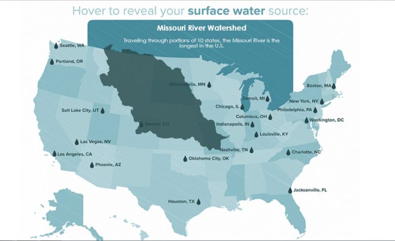
Source: Clarke Print Screen
View Interactive Maps and Read More: Clarke
Media
Taxonomy
- Watershed Management
- Resource Management
- Aquifer
- Watershed
- Aquifer Recharge
- Integrated Watershed Management
- Consumption
- Water Resource Management
- Aquifer Recharge