Why Volunteers Are Tracking Down Road Salt in Streams
Published on by Water Network Research, Official research team of The Water Network in Social
With help from Stroud Water Research Center, community scientists and watershed groups are measuring the impact of salt pollution on fresh water and taking action.
Months after the icy conditions that brought the spreading of deicer and a salt spike in Tookany Creek two times saltier than seawater, an army of volunteers descended upon dozens of sites in small streams that feed the Delaware River. They were on a mission to discover how widespread, severe, and long-lasting the salt contamination is in their local communities, as well as in the larger Delaware River watershed that provides drinking water to more than 15 million people.
Called snapshots, these single-day synoptic sampling events create a high-resolution picture of stream health. They eliminate the variable of changing seasons and weather as volunteers measure, within the span of an afternoon, how salty streams are throughout a watershed or region. The snapshots also can be used to gain evidence of long-term groundwater contamination and can help to identify specific sources of salt pollution.
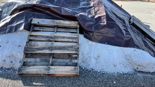
An improperly stored road salt pile uphill from a stream. Photo: Carol Armstrong.
Stroud Water Research Center has helped many of its partner organizations to gather high-quality data during snapshots. The snapshots fill in water quality data from areas not captured by USGS streamgages or the Stroud Center’s EnviroDIY network, both of which require some expense and ongoing maintenance.

Taxonomy
- Stream Restoration
- road salt impact