Part 4: AI-Driven Aquifer Detection for Safer Underground MiningBy: Dr. Hossein Ataei FarAI cannot replace physical geophysical surveys, drillin...
Published by Hossein Ataei Far, 1.519M+ LinkedIn impressions in 4 days| Driving sustainable |Bankable climate solutions
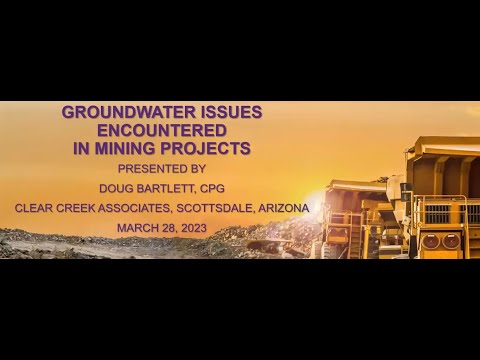
Part 4: AI-Driven Aquifer Detection for Safer Underground Mining
By: Dr. Hossein Ataei Far
AI cannot replace physical geophysical surveys, drilling, or on-site hydrogeological testing. However, it can significantly enhance these methods by integrating geophysical, geological, geochemical, remote-sensing, and historical data to improve prediction accuracy, reduce uncertainty, prioritize high-risk zones, and optimize investigations—supporting safer and more efficient mine planning while mitigating water-inrush risks.
1. How AI Supports Aquifer Detection and Risk Assessment
Traditional methods remain essential, including:
*Core logging
*Structural and geological mapping
*Geophysical surveys: Electrical resistivity, seismic methods, electromagnetic methods
*Water-pressure and hydrogeological tests
*3D geological and groundwater modeling
AI augments these methods through:
1. 1 Data Integration & Pattern Recognition
1. 2 Predictive Mapping & Modeling
1.3 Uncertainty Reduction & Investigation Prioritization
1. 4 Real- Time Monitoring & Early Warning
2. Key AI Techniques and Applications
2. 1 Supervised Machine Learning
2. 2 Deep Learning
2. 3 Geophysics + AI Inversion
2. 4 Risk and Vulnerability Mapping
3. Practical AI-Driven Workflow
*Compile Multi-Source Data: Geological, geophysical, borehole, hydrogeological, geochemical, remote-sensing, and historical mine-water data.
*Preprocess & Engineer Features: Clean, standardize, address data gaps, and develop relevant geological and hydrogeological features.
*Train & Validate AI Models: Apply XGBoost, Random Forest, CNNs, Transformers, and site-specific ML/DL models.
*Interpret Results: Use explainable AI (e.g., SHAP) to identify key drivers and quantify uncertainty.
*Integrate into Mine Planning: Support grouting, mine design, dewatering, groundwater control, monitoring, and water-inrush preparedness.
*Model Sustainability: Assess water and energy impacts and support long-term responsible mine-water management.
4. Key Limitations
AI should be considered an augmentation tool—not a replacement for field investigation.
Key limitations include:
*Dependence on high-quality ground-truth data.
*Need for site-specific calibration and validation.
*Potential bias from incomplete or unrepresentative datasets.
*Difficulty transferring models between different geological settings.
*Requirement for expert geological and hydrogeological interpretation.
*AI predictions should be verified through drilling, geophysics, and *hydrogeological testing before critical engineering decisions.
Proactive Mine-Water Risk Management
Hazard Mapping → AI Prediction → Uncertainty Assessment → Targeted Investigation → Hydrogeological Modeling → Engineering Controls → Real-Time Monitoring → Early Warning
5. Best Practice:
AI + Geophysics + Geology + Hydrogeology + Engineering Judgment—not AI as a standalone tool.
Video: (YouTube)
By: Dr. Hossein Ataei Far
AI cannot replace physical geophysical surveys, drilling, or on-site hydrogeological testing. However, it can significantly enhance these methods by integrating geophysical, geological, geochemical, remote-sensing, and historical data to improve prediction accuracy, reduce uncertainty, prioritize high-risk zones, and optimize investigations—supporting safer and more efficient mine planning while mitigating water-inrush risks.
1. How AI Supports Aquifer Detection and Risk Assessment
Traditional methods remain essential, including:
*Core logging
*Structural and geological mapping
*Geophysical surveys: Electrical resistivity, seismic methods, electromagnetic methods
*Water-pressure and hydrogeological tests
*3D geological and groundwater modeling
AI augments these methods through:
1. 1 Data Integration & Pattern Recognition
1. 2 Predictive Mapping & Modeling
1.3 Uncertainty Reduction & Investigation Prioritization
1. 4 Real- Time Monitoring & Early Warning
2. Key AI Techniques and Applications
2. 1 Supervised Machine Learning
2. 2 Deep Learning
2. 3 Geophysics + AI Inversion
2. 4 Risk and Vulnerability Mapping
3. Practical AI-Driven Workflow
*Compile Multi-Source Data: Geological, geophysical, borehole, hydrogeological, geochemical, remote-sensing, and historical mine-water data.
*Preprocess & Engineer Features: Clean, standardize, address data gaps, and develop relevant geological and hydrogeological features.
*Train & Validate AI Models: Apply XGBoost, Random Forest, CNNs, Transformers, and site-specific ML/DL models.
*Interpret Results: Use explainable AI (e.g., SHAP) to identify key drivers and quantify uncertainty.
*Integrate into Mine Planning: Support grouting, mine design, dewatering, groundwater control, monitoring, and water-inrush preparedness.
*Model Sustainability: Assess water and energy impacts and support long-term responsible mine-water management.
4. Key Limitations
AI should be considered an augmentation tool—not a replacement for field investigation.
Key limitations include:
*Dependence on high-quality ground-truth data.
*Need for site-specific calibration and validation.
*Potential bias from incomplete or unrepresentative datasets.
*Difficulty transferring models between different geological settings.
*Requirement for expert geological and hydrogeological interpretation.
*AI predictions should be verified through drilling, geophysics, and *hydrogeological testing before critical engineering decisions.
Proactive Mine-Water Risk Management
Hazard Mapping → AI Prediction → Uncertainty Assessment → Targeted Investigation → Hydrogeological Modeling → Engineering Controls → Real-Time Monitoring → Early Warning
5. Best Practice:
AI + Geophysics + Geology + Hydrogeology + Engineering Judgment—not AI as a standalone tool.
Video: (YouTube)