NEWS NOTES ON SUSTAINABLE WATER RESOURCESInterior Low Plateaushttps://www.nps.gov/articles/interiorlowplateausprovince.htmThe Interior Low Plate...
Published on by Tim Smith, Employee at Retiree & P/T Consultant
Interior Low Plateaus
https://www.nps.gov/articles/interiorlowplateausprovince.htm
The Interior Low Plateaus exist at the southeastern extent of the Central Lowlands, the boundary occurring where the maximum extent of Pleistocene glaciers reached. The Interior Low Plateaus are almost completely horizontal beds of Paleozoic sandstone, shale, and limestone. The entire province is divided northeast-southwest by a fold axis known as the Cincinnati Arch. The area is also home to two structural domes that have been eroded to form basins lined with inward-facing cuestas.
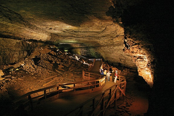
The limestone of the province is marked by well-developed karst topography, including Mammoth Cave National Park. Mapping of Mammoth Cave is ongoing, but currently 480 km (300 mi) of caverns are mapped, making it the longest on earth. The caves are well decorated including remarkable gypsum crystals and travertines, and include great rooms and a large underground river.
The Interior Low Plateaus are home to widespread but small-scale coal, petroleum, and natural gas mineral resources. In addition, fluorite (used in steel production) and phosphate are mined extensively in the region.
NOTE: More information on Sustainable Water Resources is available at https://sites.google.com/site/sustainablewaterresources/