SWOT Mission: Why This Satellite Is Mapping the World’s WaterThe first global study of Earth’s bodies of water is underway. Learn why it’s...
Published on by Water Network Research, Official research team of The Water Network
The first global study of Earth’s bodies of water is underway. Learn why it’s important and about the satellite making it possible.
From wildfires to record-setting unseasonable temperatures – extreme weather events are becoming more severe and frequent.
Globally, the intensity of extreme droughts and rainfall increased “sharply” over the past 20 years, according to a study published in Nature Water journal in March using data from GRACE and GRACE-FO satellites.
In the western US, warmer and drier conditions, a byproduct of climate change, have led to longer-lasting fire seasons – causing fires to burn over larger areas in recent decades, according to the National Oceanic and Atmospheric Administration. The 2021 winter storm in Texas that, at its height, left nearly 10 million people without power; the 2022 summer heatwaves in Europe, leading to more than 20,000 heat-related deaths; and the recent Canadian wildfires are just a few of many examples of the increasing intensity of extreme weather events.
Getting a deeper look into Earth’s oceanography – the study of the oceans and their properties – can help scientists, researchers and policymakers better understand climate change and the water cycle and better predict and respond to natural disasters such as floods and droughts.
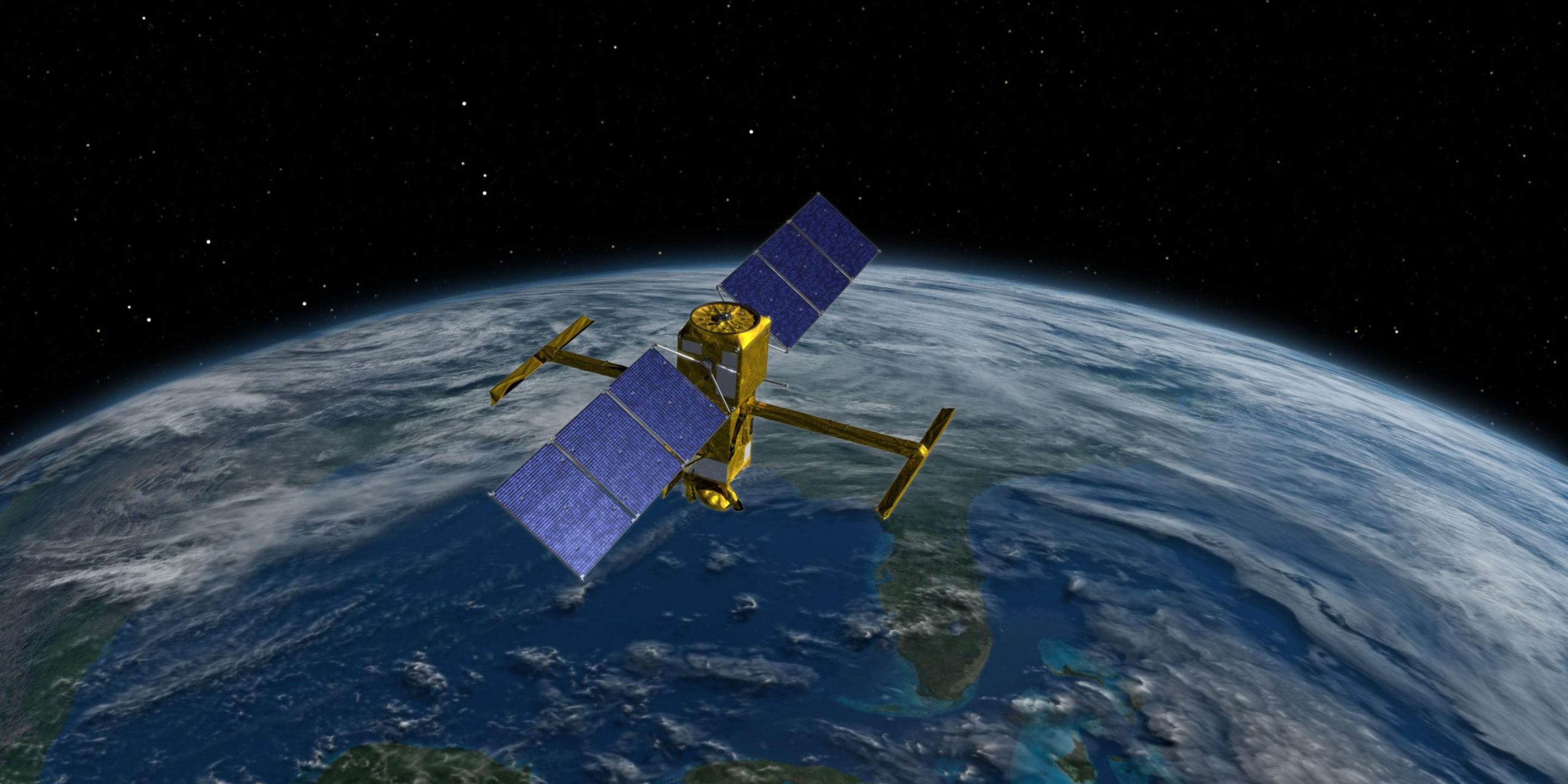
That’s why the Surface Water Ocean Topography (SWOT) mission is underway. A joint mission developed by NASA and the French Space Agency, with contributions from the Canadian Space Agency and the United Kingdom Space Agency, SWOT launched into space in 2022 and is orbiting Earth. Over the next few years, the satellite will obtain the most comprehensive view of the world’s surface water.
SWOT mission fast facts
What: The SWOT mission is providing the first global, complete look at the Earth’s oceans, the land and freshwater resources, and the water supply-demand chain. It will survey at least 90% of the world’s surface water and take measurements 10 times more accurately than any previous Earth-observation satellite.
When: The SWOT satellite was launched in December 2022. The satellite will orbit the Earth for at least three years to get all of its measurements. NASA shared its first findings publicly in March.
The impact: The findings from SWOT will benefit any decision-making that involves water management, according to NASA’s Jet Propulsion Laboratory – from wildlife area monitoring and coastal protection to hydropower. The mission will help improve our ability to predict and respond to natural disasters such as floods and droughts, as well as reveal previously unseen details about Earth’s water due to the high-definition quality of the SWOT satellite images.
Attached link
https://www.honeywell.com/us/en/news/2023/06/swot-mission-why-this-satellite-is-mapping-the-worlds-waterTaxonomy
- Groundwater
- Groundwater Assessment
- Groundwater Modeling
- Groundwater Resource
- Satellite