Best Use of Flood Plains?
Published on by LOKESH PUNJ, A B.TECH. Agr Engg, PGDM-SPA IIMA (1977-9) 25 yrs in Water Piping / Irrigation/Infra Projects in Technology
I wish to know from hydrogeologists and other professionals: what is the best use of flood plains of any river system. For what purpose do you use the flood plains?
Are there any countries that have defined public policy for economic use of flood plains? Also what's some free software available to mark river flood plains?
Help much appreciated.
Taxonomy
- Water
- Modelling
- Hydrological Modelling
- Flood Management
- Flood Modeling
- Flood management
- Flood damage
- Flood prediction
- Flood
- Flood Insurance
- Sustainable Livelihoods
- Software
21 Answers
-
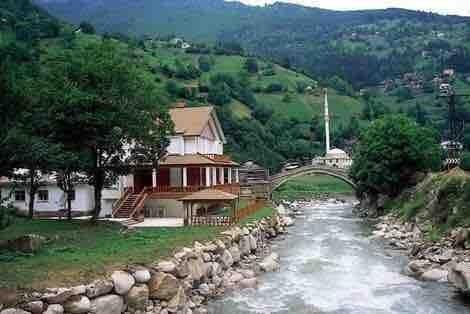
It looks like the following building in Turkey, is built on the floodplain:
Floodplain
https://en.wikipedia.org/wiki/Floodplain
Best regards,
Mashallah Ali-Ahyaie
1 Comment
-
Summer Villa
-
-
Hello Lokesh,
One may consider the following link and its references:
Floodplain
https://en.wikipedia.org/wiki/Floodplain
All regards,
Mashallah Ali-Ahyaie
1 Comment
-
I think there is abundantly rich detailed info available on Flood Plains of great Rivers - i.e. Nile..
-
-
Since flood plains are the areas that are inundated when a river flexes, these are very fertile areas due to constant deposition of silt but may be low in humus and nitrogen. I suppose short duration non-permanent crops will be suitable for such areas, From environmental / ecology point of view, the ideal option would be to leave it undisturbed.
-
Dear Dr. Frank Ahlhrn / Dear Mr. Lokesh Pun,
Please kindly provide a free link for downloading of ((the southern North Sea: Long-term perspective in coastal zone development (Springer ISBN: 978-3-642-01773-5,)) if available.
Best regards,
Mashallah Ali-Ahyaie
-
The question is put in a language of a person who knows about the subject. It would have been fair to others to write what one knows and raise the doubts.
-
Dear Dr. Frank Ahlhorn,
Such a valuable source (Springer ISBN: 978-3-642-01773-5) has to be available worldwide, free of charge, in pdf, considering the prevalent ignorance regarding the flood control in general.Do you have any URL, in this regards?
Sincerely yours,
Mashallah
-
Best use is preservation of floodplain functions or even enhancement by landscaping with native wetland plants to increase value for water quality improvements and wildlife habitat In the US we protect them under federal Clean Water Act and Executive Order for Floodplain Management
-
Hello Lokesh, The web is quite rich, in this regards: https://www.google.com/search?q=what+is+the+best+use+of+floodplains+of+any+river+system&espv=2&biw=1024&bih=533&source=lnms&sa=X&ved=0ahUKEwj02tKbzYnNAhUJvBoKHRU-BjUQ_AUIBigA&dpr=1.25 Images; https://www.google.com/search?q=what+is+the+best+use+of+floodplains+of+any+river+system&espv=2&biw=1024&bih=533&source=lnms&tbm=isch&sa=X&ved=0ahUKEwjavL-gzYnNAhVEnRoKHe6qCMEQ_AUIBygB Video's: https://www.google.com/search?q=what+is+the+best+use+of+floodplains+of+any+river+system&espv=2&biw=1024&bih=533&tbm=vid&source=lnms&sa=X&ved=0ahUKEwjfutvxzYnNAhWGBBoKHVS1AREQ_AUICSgD&dpr=1.25 All regards, Mashallah
-
Best use of floodplains : Traditionally floodplains have been used for agricultural and urban development because they are flat and (in the case of urban development) near rivers for transport, etc. Banks and walls have been built to prevent flooding. However this causes higher flood levels in rivers because the flow area is reduced. The best use of floodplains is to allow the areas to flood and only use the land for purposes that are resilient to flooding (for example, pasture where animals can be removed from the floodplain in flood periods). This approach means that flood levels are lowered and downstream flood flows are reduced. Bearing in mind that many existing floodplains have defences, the use of floodplains could be improved by the construction of ‘polders’ that store flood water and reduce downstream flooding. However this is a very artificial situation. Another possibility is to breach or remove the defences, allow flooding on the floodplains and allow the rivers to develop naturally. This is only possible where the impacts of flooding on existing floodplain development are accepted (e.g. loss of agricultural land, flooding of properties, etc.).
Defined public policy for economic use of flood plains : There are countries that have floodplain policies related to the use and development of floodplains, including the UK. However they have to deal with an existing situation where development on floodplains already exists. The policies are therefore often concerned at avoiding new development in flood risk areas, and measures to reduce risk to existing development.
Free software available to mark river flood plains : HR Wallingford does not use free software for this purpose but I think the HEC-RAS modelling system from the USA is free.
-
I'd like to refer to a methodology developed within a research project in the EU Interreg program for the southern North Sea: Long-term perspective in coastal zone development (Springer ISBN: 978-3-642-01773-5). Therein a concise overview is given about possibilities how to develop flood plains.
1 Comment
-
Thanks.Can you share the abstract please. India with Flood Plains of Rivers getting obstructed or having developed without regulations may need European model...or may have to develop very own Indian model.
-
-
1 Never build on a flood plain. 2 You can grow crops on a flood plain if you can aford loosing a crop every so many years. 3 You can grow fruit trees, but onky if they can survive under water during a flood. 4 You should NEVER sleep on a flood plain if you want to live a long life. The flood plain belongs to the RIVER, and the river is always RIGHT!
1 Comment
-
I appreciate yr precise feedback.
-
-
Thanks to all who have provided valuable insight on the subject.I am inspired by Flood water containment Tanks interlinked that Tokyo has built and wish to propose that on the vast Flood Plains of Rivers in India, rather than Habitats and Infrastructural Bridges and Elevated Highways bisecting the flood plains, it is possible to use deep underground spaces to create Flood and Storm water retention structures that can release waters to augment River Flows when required.The top cover of soil can be retained as it is.We must think of using part of Flood Plains to store surface waters for multiple uses including creating more space for allowing flood waters in. Rest of it is as per practices fillowed world wide.
I will research more on the wealth of materials provided in response.
Best Regds
Lokesh
-
Dear lokesh Punj, A floodplain or flood plain is an area of land adjacent to a stream or river that stretches from the banks of its channel to the base of the enclosing valley walls and experiences flooding during periods of high discharge. Knowing where flood waters may rise to in the event of an extreme storm is important for land use planning and emergency management. This knowledge allows us to direct land uses away from areas of risk – areas that could be inundated with flood waters could trap people from escaping from a flooded area and could damage private property and public infrastructure. Flood plains are determined based upon information gathered, analysed and synthesized as part of a flood study. Flood studies are technical reports that use topographical information, surveys of infrastructure such as the size of bridges and culverts, land use information, weather data, stream flow data, and detailed hydraulic and hydrologic models of each watershed in order to determine the spatial extent of a flood plain. The flood plain boundaries are shown on detailed maps. Flood studies and flood plain mapping are prepared and approved for the Toronto and Region Conservation Authority (TRCA) by qualified Water Resource Engineers using standards and criteria established by the Ontario Ministry of Natural Resources. As each of the variables mentioned above can change (i.e. topography, infrastructure, land use, weather data, stream flows, and hydraulic and hydrological modelling techniques), so too will the resulting flood plain boundary. In order to ensure that flood plain boundaries are current and up to date, new flood studies are commissioned every 10 to 20 years for each watershed within TRCA’s jurisdiction. When flood plain boundaries change some lands that were formally within a flood plain are removed and others are added. Development in a designated flood risk area, development in a flood plain and development in a climate change flood zone shall be subject to the prior written approval of the Minister of Environment and Conservation (the “Minister”) in accordance with the Act. The Water Resources Management Division of this Department will continue as the lead agency with respect to flood plain management. This role will include but is not limited to: i. Evaluating all applications for approval under section 48 of the Act and making the appropriate recommendations in accordance with this policy. ii. Carrying out hydrotechnical studies, flood risk analyses and mapping to the extent possible with limited funds provided. iii. Continuing to monitor areas of flood risk such as Badger, Deer Lake and Steady Brook to provide flood warning and flood status reports. iv. Providing to the public information, data, maps, guidelines for flood proofing and other materials that will be useful in reducing flood damage. v. Providing technical expertise and assisting Fire and Emergency Services – Newfoundland and Labrador in the event of a flood emergency. vi. Continue with the ability to forecast flooding using computer models and real time data. Regards, Prem Baboo
-
Recognize first that the term "floodplain" does not mean much unless you attach a probability to it. So when you are talking about the best use of a floodplain it may be quite different if you are talking about the 50-year floodplain or the 500-year floodplain. The less the probability and hence risk of inundation, the more likely that part of it can be developed. In the U.S. we typically restrict development within the 100-year floodplain. For planning purposes, areas that flood regularly can be used as park land for recreational purposes, particularly day use (picnic areas, hiking or running paths, wildlife observation). Some jurisdictions are a bit more aggressive and cite amphitheaters for outdoor musical listening and so forth. See what the City of Dallas is proposing for the Trinity River corridor (http://www.trinityrivercorridor.com). If a portion of the floodplain is a wetlands, it is best left that way, since wetlands provide valuable functions for water storage, as well as settling basins that help improve water quality and provide habitat for wildlife.
-
One double use for flood plain areas if the land is set to handle it: Dig flood water retention areas which can be large, open flat recreational areas in drier times. But when flood water reaches a prescribed, pre-damage level the flood water goes into the retention area vs going into homes, etc. It's not an absolute fix but can mitigate damage. The water then drains when the stream returns to normal level.
-
Flood plain except flood way can be used for various development works like parks and recreation, residential and commercial developments such that the developments do not endanger the downstream and upstream features due to erosion or inundation.
-
Dear Lokesh, Please go to www.floods.org for a wealth of information. It is the website for the Association of State Floodplain Managers who are devoted to issues you are seeking answers to. Good luck! Bill Parrish
-
I have worked with farmers in Senegal to develop crop rotations that take advantage of seasonal flooding then droughts to select crops that marry well in rive flood plains. Say, flood rice(for export) followed by tomatoes(for local markets). Soil management is the key. I don't know if this helps?
-
I giving a link where you will find information of your interest for the first part of your query. http://nationalgeographic.org/encyclopedia/flood-plain/
-
i know the answer of the question ,but i want first to be saved grain produced land fast. after that i see the matter of The Water Network.
-
Flood plains are useful in evaluating economic viability for real estates, urban planning and even irrigation...however am not aware of any national policy on the subject